The truth is that the State of Washington has some very spectacular scenery. And Oregon’s not so bad either. Today marks two weeks since we re-entered the lower 48 and we have been mostly just kicking around in those two states. Not making much progress so far on our march back to Florida. However, we did cross into California yesterday and are now in Hat Creek, California. But before I get into that let me tell you about the big cat that I saw in British Columbia and forgot to mention in my previous post.
Somewhere near Jackass Mountain (love that name!) we were following another motorhome down the highway and a huge cat crossed the road in front of the other motorhome. So it was a fleeting glimpse of the cat for me and Joan did not see it at all. But it looked to be slightly bigger than our Border Collie, Daisy and she is sixty pounds. My subsequent research tells me that there are only three varieties of wild cats in BC. Bobcats, Cougars and Lynx. This cat appeared to be black and had a long tail. So that ruled out the Bobcat. And from what I have been able to read only the Lynx sometimes is dark enough in color that it appears to be black. So I’m guessing that is what I saw.
When we crossed into Washington from BC we chose Bellingham as our first base of operations. This is a little city about fifty miles north of Seattle. I expected it to be a sleepy little place, but was wrong. I don’t know the exact demographics of the Seattle area, but I suspect it is a very young population. And while we were there it seemed that everyone was headed out in their SUV’s and minivans with the “Baby on Board” signs. Probably those soccer moms dropping the kids off, but in any event the place was just way too busy for us. Adding to the mayhem in the area was the fact that it also was a long weekend for British Columbia. Every campground was full and we ended up dry camping in the parking lot of a casino for the long weekend. Dry camping means that we had no electric, water or sewer hookups. That’s not as bad as it sounds because we have water and sewer storage on board and we can operate on generator and/or battery power for quite a while. But three days in the parking lot was plenty for us.
We thought Bellingham would give us easy access for a car trip to North Cascades National Park. It was about 85 miles to the east of us. The west side of the park is very nice with some beautiful mountain vistas. This is where we entered and probably since we had just toured all around gorgeous Alaska and driven down through spectacular BC we were not quite as taken with the park as we would otherwise have been. But we did read that the most beautiful part of the park was another 60 miles east. Since we had already planned on “only” a 170 mile drive we did not want to add another 120 miles to our day trip. We chose to save that part of the park for a future trip out this way.
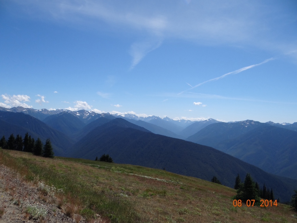
From Bellingham we drove down through Seattle and Tacoma and camped in another casino. However, this one had an actual campground with full hookups for us and it gave us access to Olympic National Park. We did this park again by car and again ran short on time and only got to see the eastern and northern sides of the park. The road is essentially a loop around the outside of the park with periodic roads going into the park interior. The park is on a peninsula that juts up between the Pacific Ocean and Puget Sound. The parts we saw were fantastic and I’m betting the ocean side on the west would be just as great. The views from Hurricane Ridge which we drove into on the north side were well worth the trip.
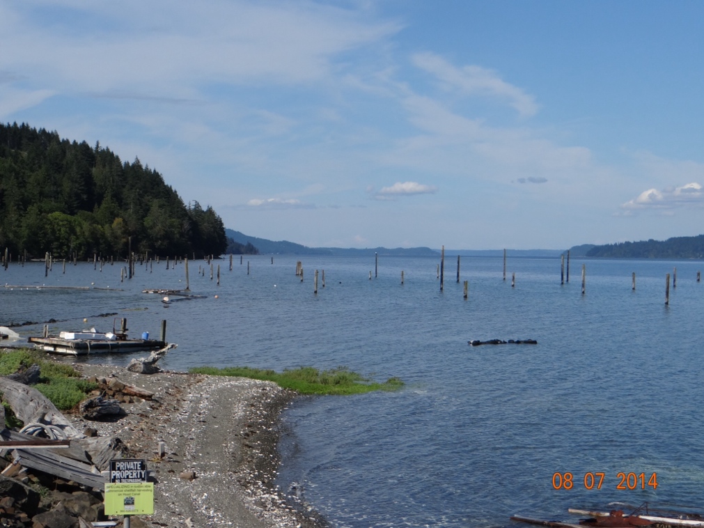
Driving back from Olympic NP we made a fascinating discovery. Have you ever wondered where fence posts come from? I mean its not like they grow on trees you know. But right here alongside the road in western Washington we found this fence post farm. I never knew they grew them in salt water.
Joan and I have driven around on the Washington and Oregon coastline on two previous trips out here. The Pacific Coast Highway is a beautiful drive from Seattle all the way down through California, but when heading south on that road you encounter many places where it seems you are driving right on the edge of a 300 foot cliff above the ocean. That sometimes makes me uneasy in the car, so I had real reservations about making the drive in the motorhome. Therefore, we decided to take a more inland route south. This also afforded us the opportunity to visit Mount Ranier National Park one day and then Mount Saint Helens the next day. Both are old volcanoes and are spectacular, but in totally different ways. Mount Ranier because of the natural beauty and Mount Saint Helens because of the devastation that is still so apparent almost 35 years after it last exploded.
On the way up toward the top of Mount Ranier we stopped to do a hike to a grove of huge trees called Grove of the Patriarchs. Mount Ranier and the other tall peaks in the area trap much of the moisture coming off of the Pacific and don’t allow it to go further east. This makes for rain forest-like conditions in places and is evidently very beneficial for growing huge trees. These trees that we hiked to I think are the biggest trees I have ever seen that are not Redwoods or Sequoias. The one on the left is a Douglas Fir and the right one is a Cedar tree. These were just two examples of several very very large trees here.
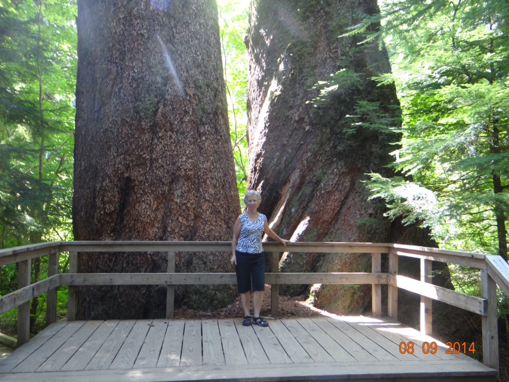
I could not have said for sure what kind of trees those were, had I not read a placque about them. I’m sharp enough to know there is a huge variety out here of what I generally call ‘”pine trees”. This is where it would be nice to have my friend Doug, the retired Saluki forestry professor, along on the trip to keep me straight. I can usually pick out tamarack, hemlock and cedar. Otherwise if it has needles where leaves would normally be I call it a pine tree. Having said that I should add that I can also identify a Christmas tree (the balls and lights do it for me).
Speaking of hikes, Joan likes to make me stop frequently and head off on some path that she has read about. I figured we would be doing a lot of this in Alaska. And since the tallest peak in North America is there I thought we might be hiking at high elevations. I bought an app for my phone to tell me the elevation so I would have an idea of how winded I might get. Its a cool app because it gives not only the elevation, but also the latitude and longitude and the boiling point of water at that elevation. Now that last feature is extremely useful, because I’m often overcome on these walks with the urge to gather sticks, build a fire and boil some water. So its very convenient to know how long this will take.
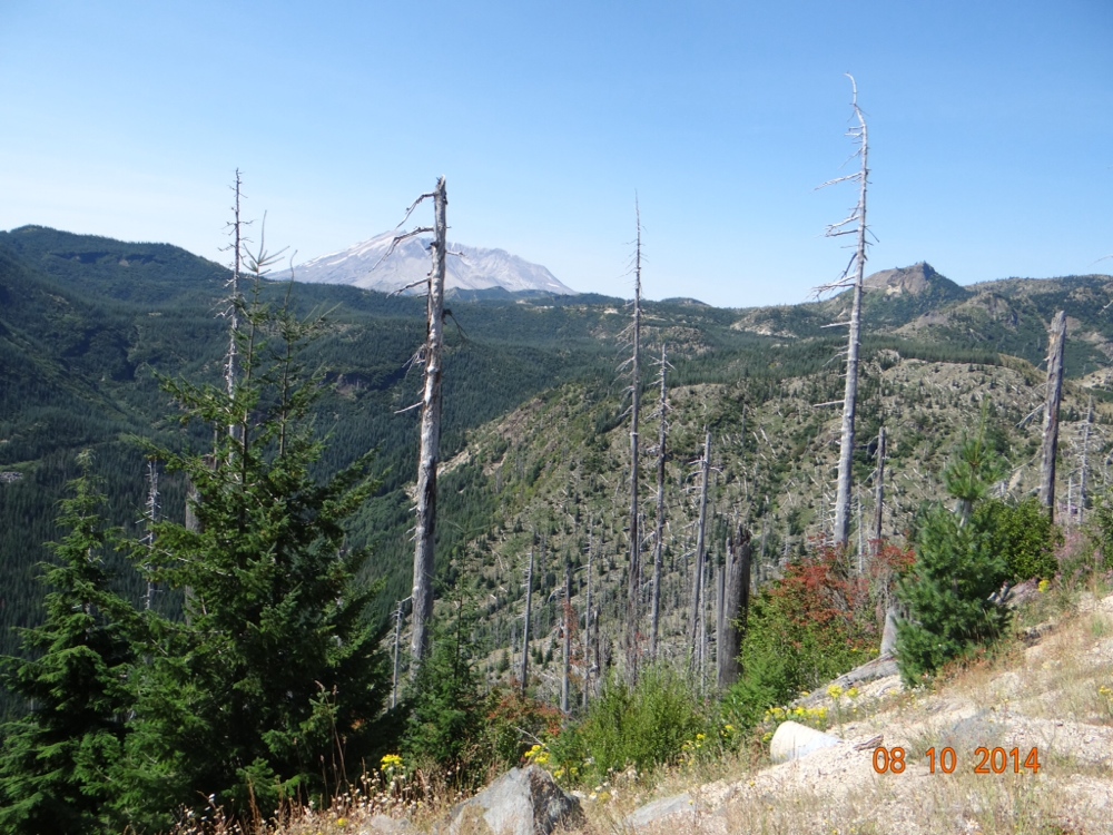
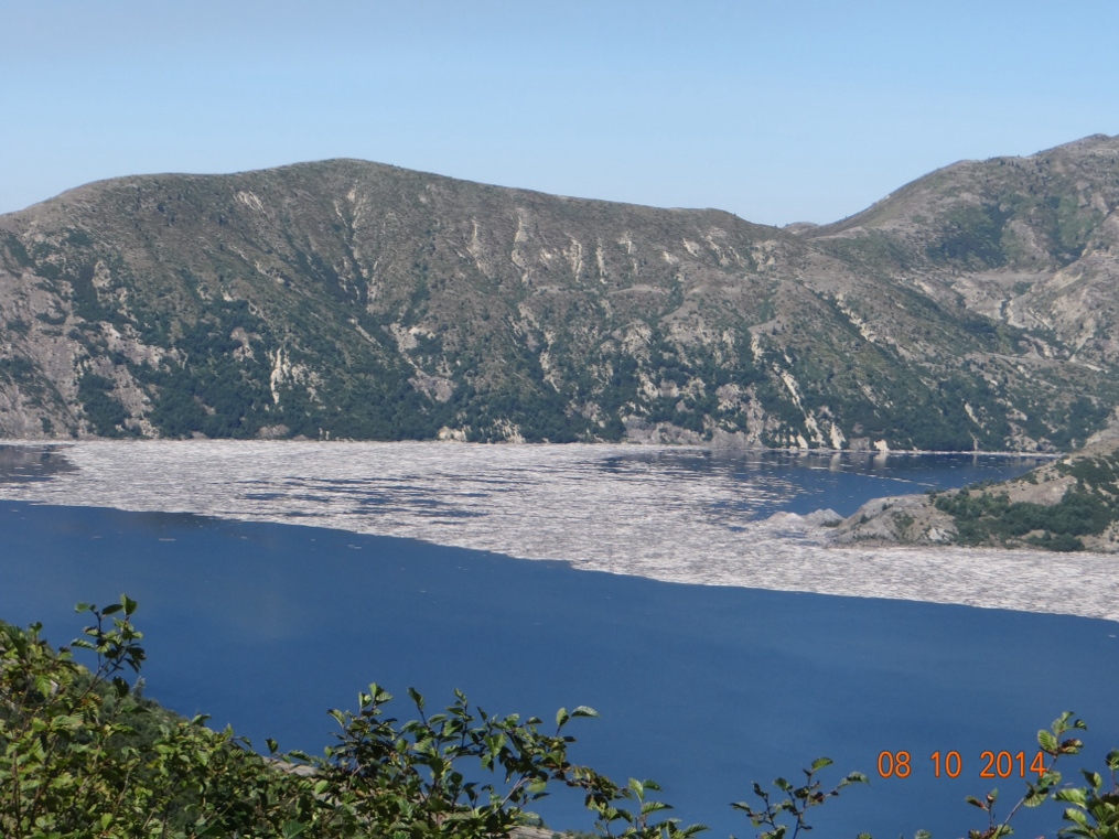
For miles around Mt St Helens the devastation is just unbelievable. Almost every mountainside facing the site of the explosion is covered with either still standing dead trees or the ground is covered with huge logs all laying facing the same direction as if swept over by some huge hand. The shot below was taken at a distance of about fifteen miles from the mountain in the background and the biggest trees are dead. One very large lake in the area is almost half covered with floating logs from the explosion. All of the grey area on the water in the lake photo below is dead logs floating on the water. It is interesting that in the areas where the dead trees are still standing the undergrowth on the ground is thriving as if nothing had ever happened. The reason for this is that the actual explosion took place on May 1, 1980 and at that time there was still eight feet of snow on the ground. The searing heat from the blast immediately killed the tall trees, but the snow blanket protected everything underneath.
From our campsite at the base of Ranier we drove east through White Pass before turning south into Oregon. Within about fifty miles on this road we had passed from the rain forest conditions to a countryside around Yakima that very much resembled what I would expect to see in Arizona, New Mexico or West Texas. Sage brush, tumbleweeds, etc.
Before we leave Washington I want to comment on some of the unusual names we ran across. In the Olympic peninsula we saw the towns of Duckabush and Dosewallips. And then there are the towns who use the same word twice–Hamma Hamma and Wis Wis. Its as if you didn’t hear it the first time so we’ll repeat it. And although not a town, I saw a road called Kitchen Dick Road. I’ll not even speculate on where that came from. Oh, and speaking of two word towns, there is Walla Walla. There seems to be a movement among the Walla Wallans to claim that the onion was invented there. Sweet onions are everywhere there, but I thought it was settled history that the onion was actually invented on the island of Bermuda by Thomas Edison while he was on vacation there. He was fresh off of having invented the light bulb, thus the similarity in the shape of the onion and the light bulb. Then I believe he sold the manufacturing rights to Henry Ford and Henry automated the process at his plant in Vidalia, Georgia. Washington is better known for its production of apples and to a lesser extent cherries. And we all know it was just south of here that Steve Jobs invented the Apple.
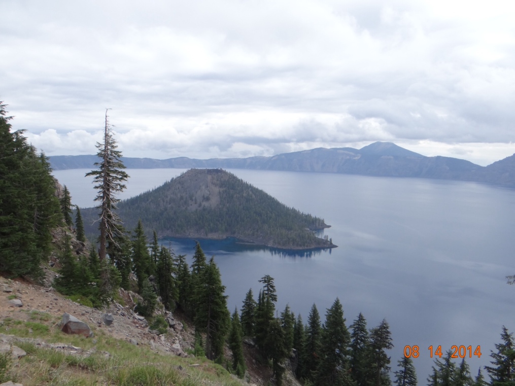
From Washington we crossed over the Columbia River and headed down through the center of Oregon eventually landing near Crater Lake National Park. Crater Lake is a little out of the way, but very much worth the trip. It is the deepest lake in the USA at over 1,900 feet deep. No matter how tall you are that’s pretty deep. It also holds the record for water clarity. Joan read that normally you can see an object down over forty feet in the water, but when conditions are just right you can see down over eighty feet. The reason that the water is so clear is that no streams or rivers drain into the lake. All of the water in it is from either rain or snow melt. The road that loops all the way around the rim is about 35 miles long. We drove about 32 miles of that and then because of construction repairs the road was closed, necessitating a 32 mile trip back over what we had just traveled. But the scenery along the drive was well worth seeing twice. Unfortunately we had an overcast sky that day and the photo ops were not what we had hoped for. The island in the lake is the top of a volcano and is known as Wizard Island because it supposedly resembles the top of a wizard’s hat.
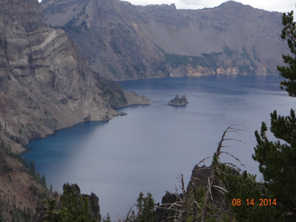
This smaller island is further around the rim of the lake and is known as Phantom Ship. Also note the multi-colored rock on the left side of the picture. The blue water in the lake is not a trick of the camera, but rather really is a very vivid blue.
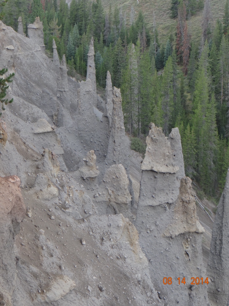
Also at Crater Lake are these natural features known as the Pinnacles. They were formed from volcanic gases bubbling up through volcanic ash and cementing the ash into solid rock. Some are hollow in the middle where the gases were.
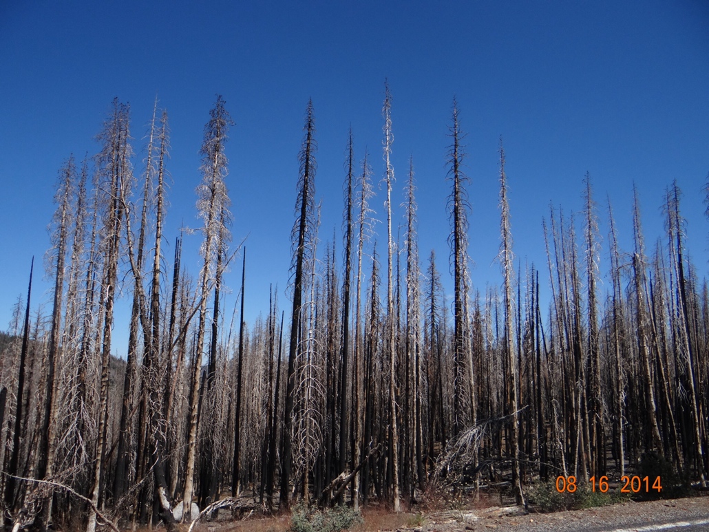
What brought us to this area of Northern California is another Volcanic National Park, Lassen. We hesitated to come to this area because it is the immediate area where the California wild fires have been raging. But the campground operator assured us that the fires were out and the area was now green. And that was true as long as you have a limited view of what “area” means. To get here we drove through miles of burned out forest and then about a mile from the campground the fire area did end.
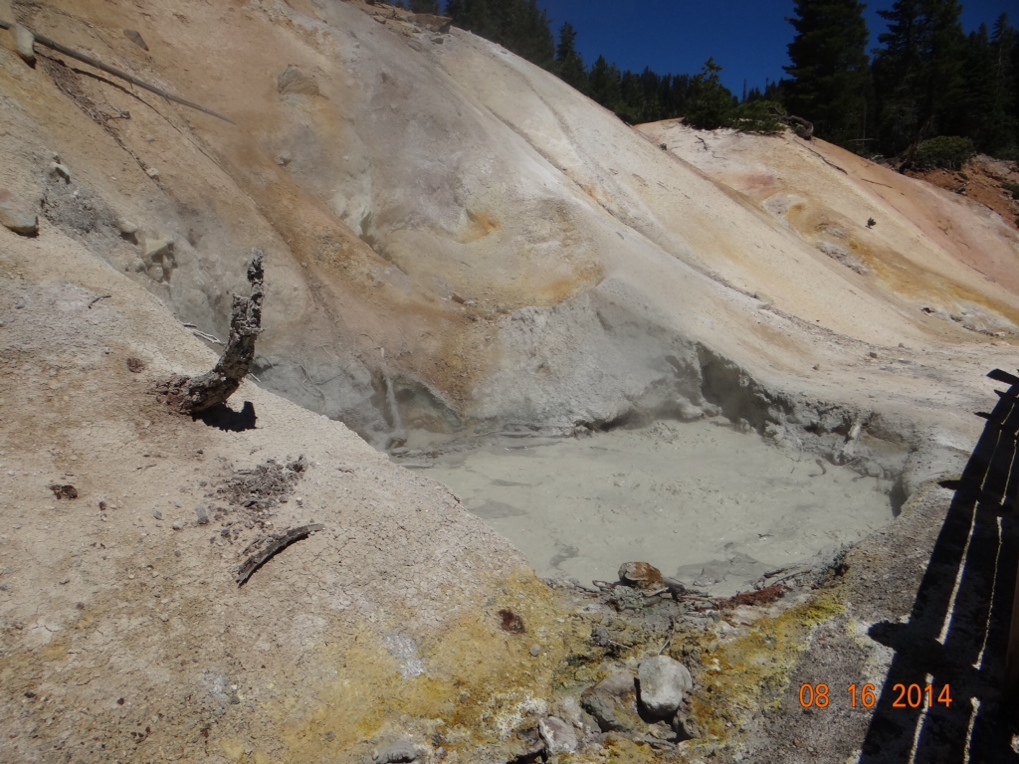
But Lassen National Park itself was well worth the trip. Lassen Peak last erupted in 1915 and along the road through the park you can still see mudpots and fumaroles bubbling up steam and sulphur gases much like are in evidence in Yellowstone. The churning and bubbling does not show up real well in the photo below, but it is going on and the smell is a very strong rotten egg odor. In my younger days of frequenting the local taverns, shooting pool with my buddies Dave, Fred and Phil, drinking beer and eating pickled eggs from a jar on the bar, I could have been described as somewhat of a fumarole myself I guess.
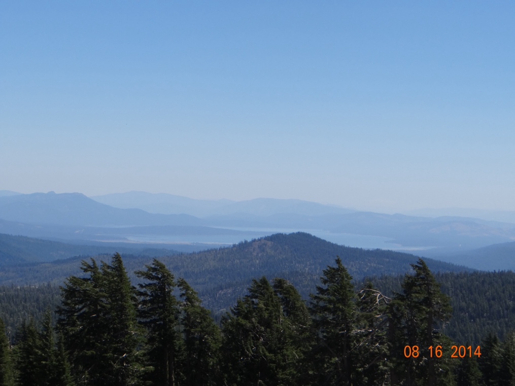
Because of the high elevation (8,500 feet) there is a very nice view of Lake Shasta about fifty miles distant. Note the haze in the air though lingering from the fires. This is not from high humidity, but rather is smoke.
I have an old friend, Edna Simpson. I say OLD because Edna has to be approaching her 150th birthday by now. But she still lives in her own home by herself, and she is still sharp as a tack and sends me lots of good jokes and stories. After my previous blog post Edna took the time to write to me, and let me know that Les Moore (who was shot six times with a 44) is actually buried in the state of Arizona where Edna lives, not in western Kansas as I had thought. I stand corrected, Edna! Thanks.
I do enjoy your blogs and look forward to seeing you again in Fla. The whole trip sounds fabby but exhausting! xxoo Sue
Well shoot Larry, I’ve read every single blog post, at least twice! Have really enjoyed following along, and especially the Joan-isms 🙂 Love you both, may the safe travels continue as you wind your way through the lower 48!
-Andy, Courtney & Jude