The Looker

I am writing this from our home in Ponce Inlet, Florida.  After driving about 15,000 miles between the motorhome and the car we arrived home on Sunday, September 21.  We left home on May 6, so the journey lasted about four and one half months.  This post is mostly to acknowledge the two great travel companions I had at my side through the whole thing; Daisy, our Border Collie, and my bride, Joan.

My liberal friends just roll their eyes and call me crazy when I say this, but my very favorite thing to do when I am driving long distances is to listen to conservative talk radio.  And my favorite bag of wind is Rush Limbaugh.  However, as you travel the vast distances that we did it is hard to keep Rush tuned in.  I have a phone app to show me the closest Rush stations, but  it is not always accurate and requires constant fiddling with the radio.  Consequently, for most of this trip I resorted to my second favorite thing, and that is listening to classic country music from the 40’s through the 70’s on Sirius satellite radio. Joan is the musician in our house and plays several stringed instruments.  I know nothing about the music (I only can play the radio, but I do that well), and when I say I like classic country music I mean mainly the lyrics.  I  find that the titles of the songs and/or the actual lines in the songs relate to so much that is going on at different times in my own life.  And for my  money, the greatest song title ever written anywhere is “If I Said You Have a Beautiful Body Would You Hold It Against Me?”  Really that works on so many levels!!

At almost 67 years of age when I hear Roy Clark sing “Yesterday When I Was Young” I start wondering how did I get to this point so quickly.  Wasn’t it just yesterday that I was relating to the John Conlee song “I’m On the Back Side of 30”??  Or when I hear Loretta Lynn sing “Don’t Come Home a Drinkin’ With Lovin’ On Your Mind”, I remember Joan giving me the same advice when I was headed out for a night with the boys.  Quite frankly though I never understood Loretta’s or Joan’s attitude on that score!!

Tom T. Hall did a song wherein he sings “There’s only three things in this world that’s worth a solitary dime–that’s old dogs and children and watermelon wine.”  I’ve never had watermelon wine, although I would like to try it.  And I’ve never been much into children until we had one of our own.  And now that there are grandchildren that takes things to an entirely new level of caring. In that song Tom T. goes on to say that “old dogs care about you even when you make mistakes”.  On this trip Daisy celebrated her tenth birthday, so, unfortunately she qualifies as an old dog.  The joints are getting stiffer and the movements slower.  And when I blasted into that cluster of buzzards on the road at 60 mph it was terribly obvious to all three of us that I had made a huge mistake.  But when I got stopped and bent down to put Daisy’s leash on her to take her outside to get the glass out of her coat she licked my hand.  Just to show me she did still care about me.

Waylon Jennings had a song about Luckenbach, Texas that starts out with the lyric “There’s only two things in life that make it worth livin’—that’s guitars tuned good and firm feelin’ women”.  As I said above I know nothing about musical instruments and that includes guitars, tuned or otherwise.  But I met what would become my own little hardbody in March or April of 1969.  I was in my second year of working in the college dormitory cafeteria.  Since most people who worked there only lasted weeks or a few months at best, I was kind of a big cheese on the wait staff.  Not the biggest cheese, but I was still pretty cheesy.  When Joan was hired toward the end of that school year, and I saw her big blue eyes and long brown hair, I thought she was just about the cutest thing I had ever seen.  So did the rest of the guys there, but I moved quickly, and we dated several times before school was out for the summer.  And then we headed our separate ways with promises to write.  Neither of us did, not even once.  But in September we started up again, and by Christmas we were getting married, which we did in June, 1970 after a nine month courtship.  She was 20 and I was 22.  That’s the way we did things yesterday, when I was young.

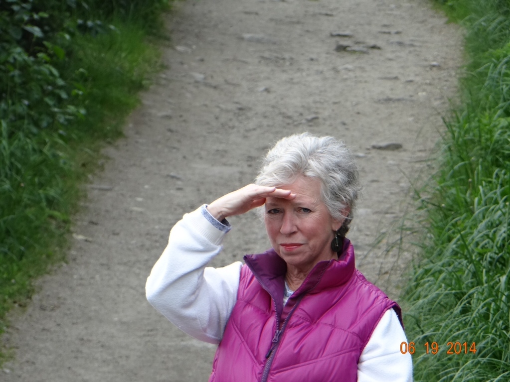
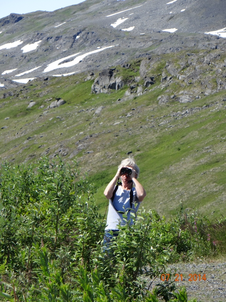
Sometime between age 20 and almost 65 women stop being CUTE.  This has happened to Joan too and now the term I use to describe her is LOOKER.  Joan is a looker.  I looked up the word in my Funk and Wagnall’s and they give it two definitions;  first, it is someone who looks at things.  Secondly though, there is an informal definition that describes a looker as a very attractive person.  My wife qualifies in both regards, and I will add that if she were a dog, she would be a Pointer.  You’ll see what I mean in the following photos from our trip.


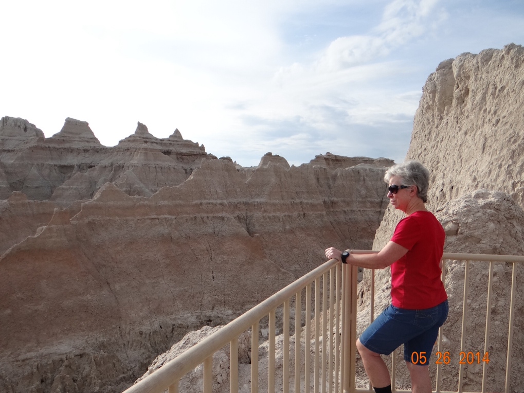
Joan looking at the Badlands 


 Joan looking at me and ignoring beautiful Muncho Lake in British Columbia


Joan looking at something! 


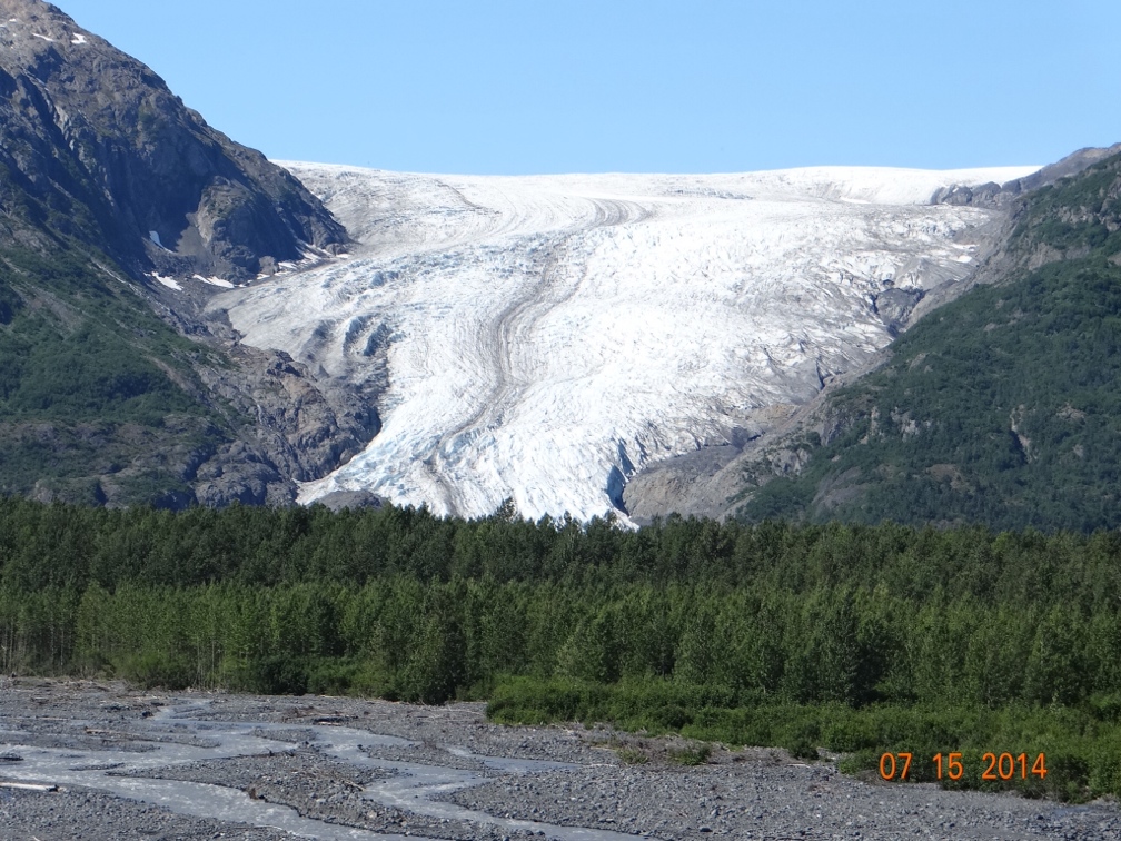
 Joan looking up close at a glacier


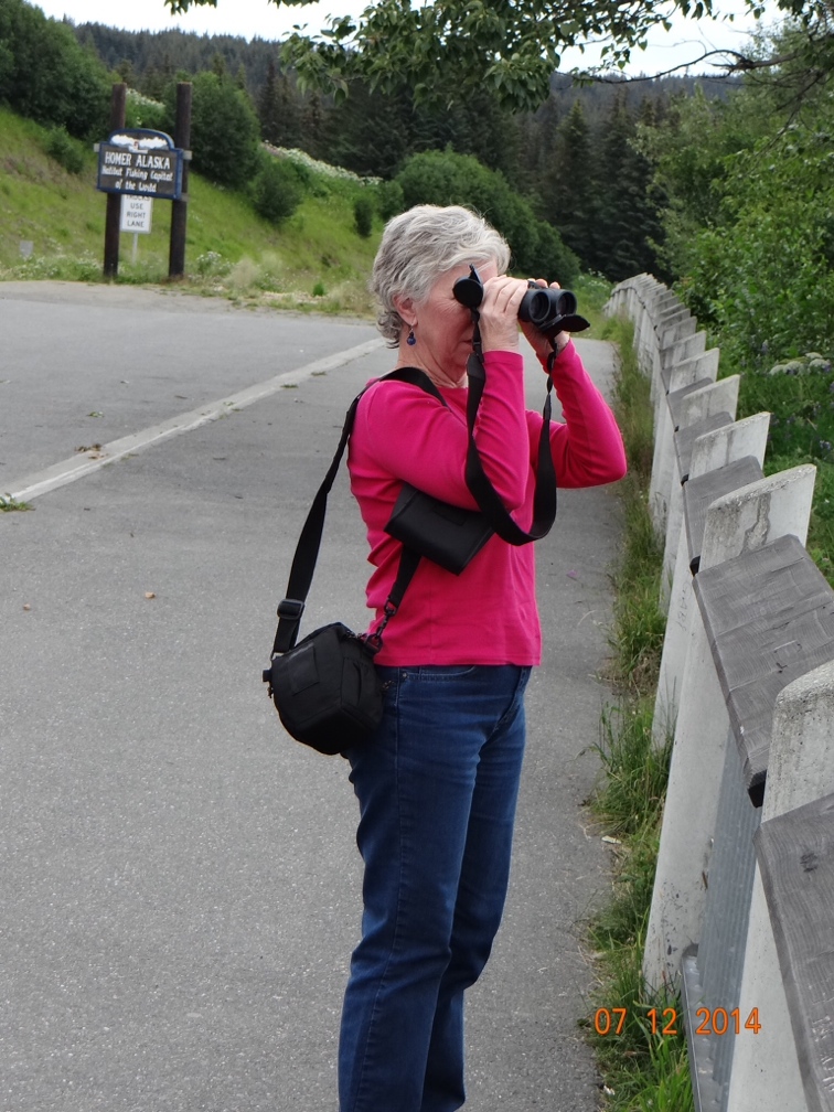
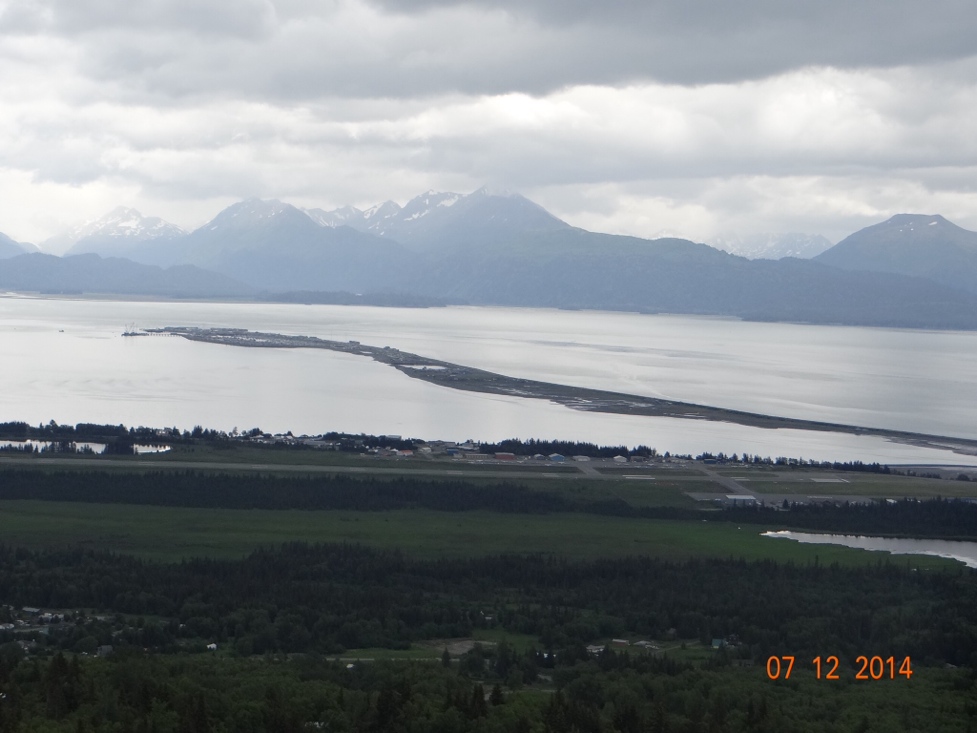
Joan looking at Homer, Alaska


 Joan looking at another glacier near Valdez, Alaska


 Joan looking at the attractions in Stanley Park, Vancouver, British Columbia


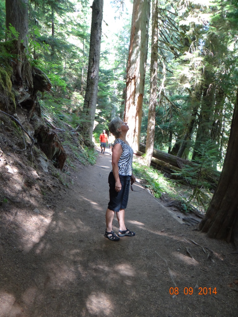
Things are looking up for Joan 


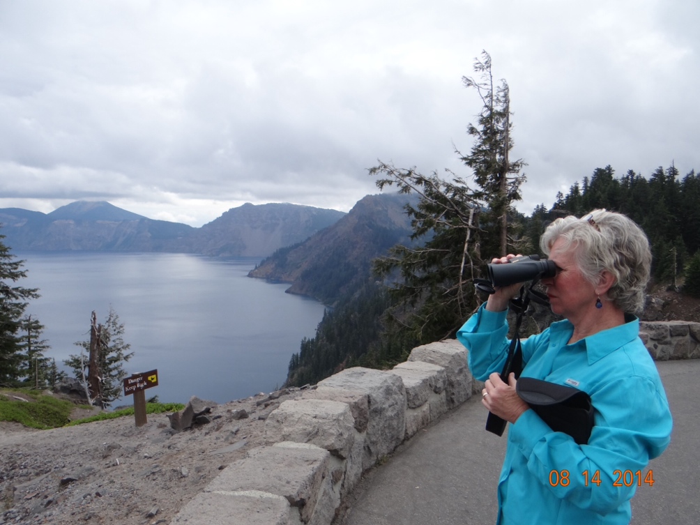
Joan looking at Crater Lake in Oregon 


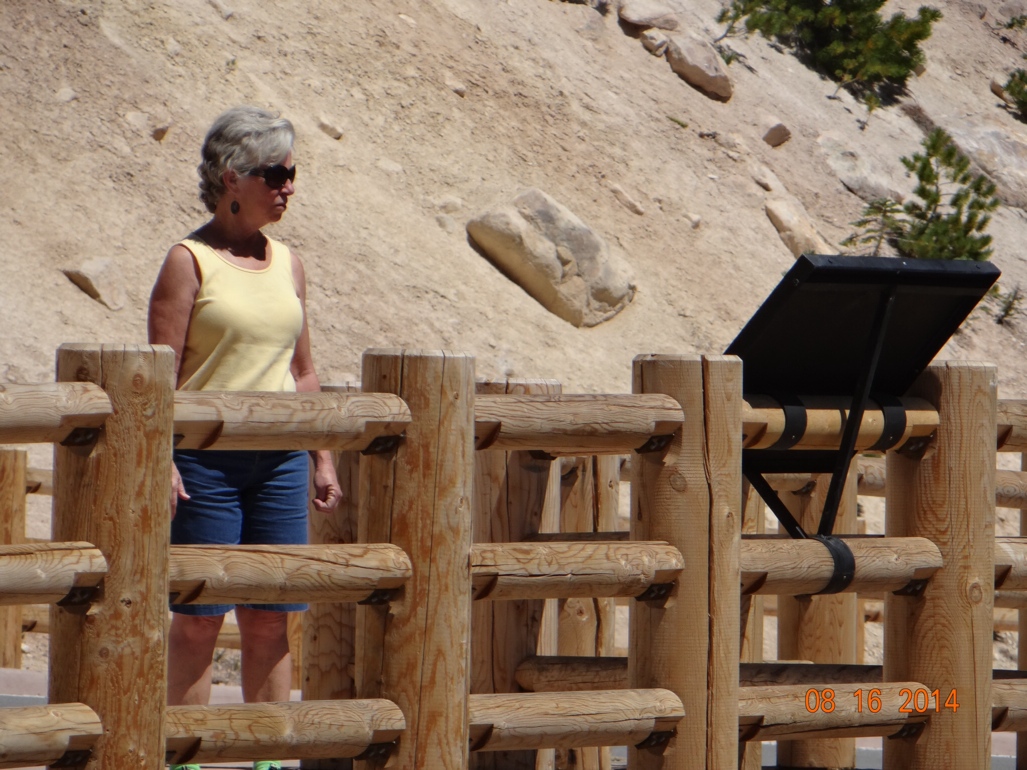
Joan looking at a fumarole in California 


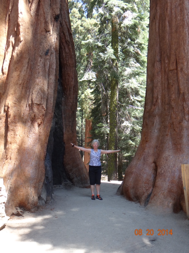
 Joan looking at a Sequoia tree (nice socks)


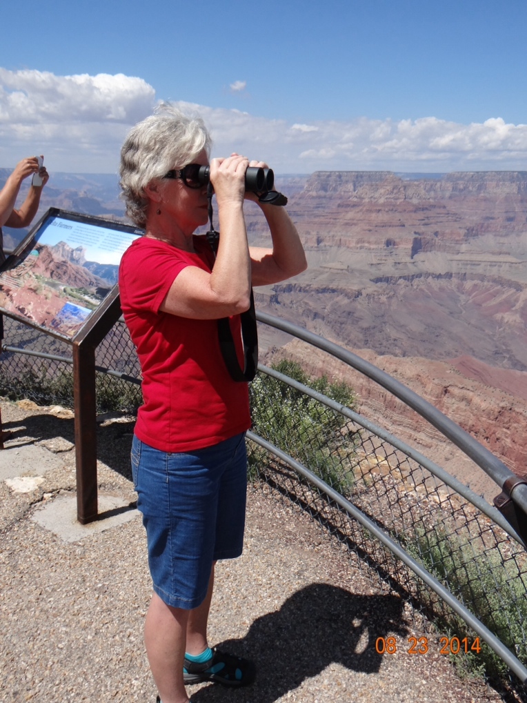
 Joan looking at Grand Canyon (nice socks)


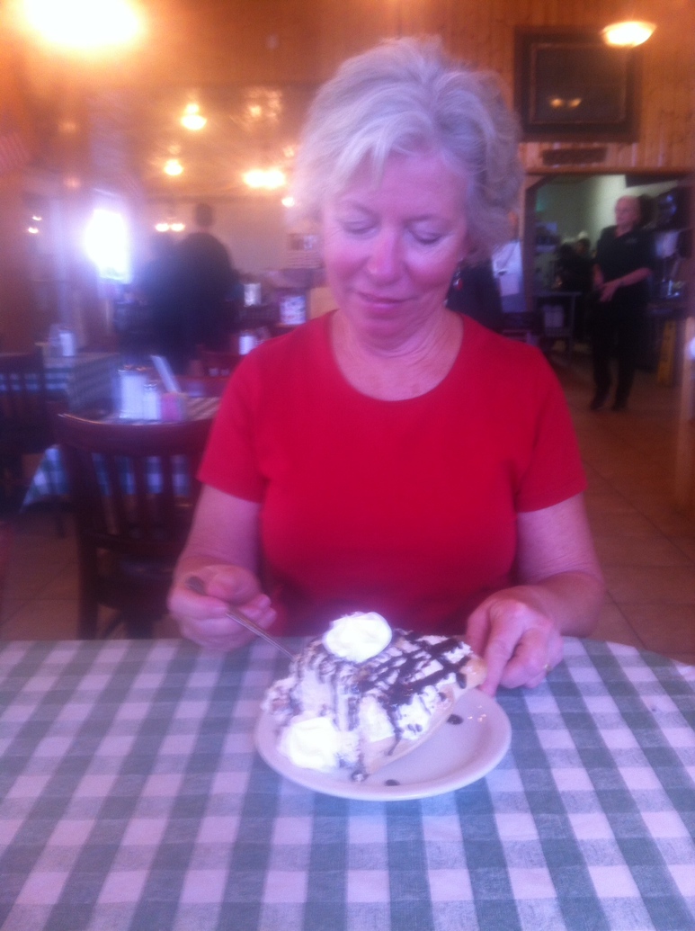
Joan looking at her huge piece of pie (so much for the hardbody) 


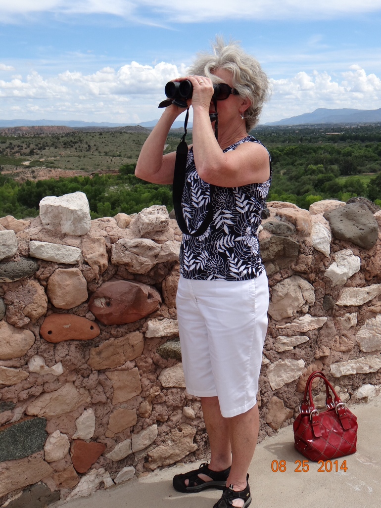
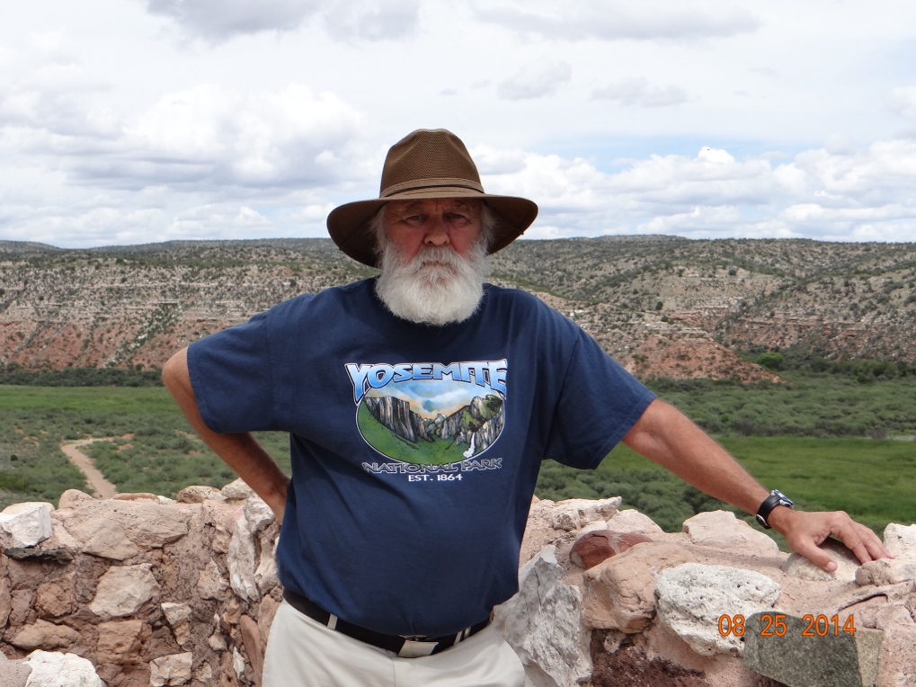
Joan looking at Tuzigoot ruins near Cottonwood, Arizona


Continue reading The Looker

Playing Chicken With A Buzzard—OR—A Pain (Pane?) In the Glass

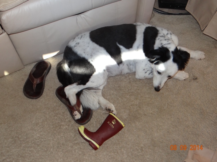
We ended up spending eight nights in Tucson, Arizona.  That was exactly twice as many nights as we spent in any one town anywhere else along our Alaska journey.  That was partially because we were having some minor repairs done on the motorhome, but also because we both like the Tucson area.  It was a little too hot this year to suit us at 104-105 degrees every afternoon.  True, it is a dry heat, but still the afternoons are just like an oven.  But the bright sun gave us a chance to tan up again after wearing jeans and long sleeves all summer in Alaska.  And because of the heat Daisy finally gave up wearing her favorite Alaska boots we bought for her and is back into flip flops, her usual Florida footwear.


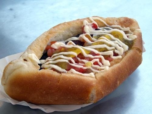
At first we were so caught up in the motorhome repairs and the sight seeing around the area that we ignored the plethora of fine eating establishments in Tucson.  We both like Mexican cuisine and we finally realized what better place to taste really good Mexican food than in a town filled with illegal immigrants, and where over half of the local TV stations broadcast only in Spanish?? Just as in Alaska, where there was a coffee stand on every corner, in Tucson there seemed to be a stand selling hot dogs or tacos on every corner.  I was not expecting hot dog stands in Tucson and don’t remember them from previous visits.    But when we decided to go out for Mexican food we had a nice sit-down kind of place in mind.  So I got on the internet and found one with really good reviews and photos that made it look attractive, and so we headed out.  But when we got there it was not in a nice section of town, and it was a place where you ordered at a window, and then took your food inside to eat or stayed outside at their tables.  But most importantly I noticed that they bragged about their version of something called “Sonoran Style Hot Dogs”.  Now, I pride myself on being something of a hot dog aficionado.  I’ve had them all over West Virginia, Pennsylvania and New York.  I’m usually strictly a chili, onion and mustard kind of guy, and the chili makes the dog for me.  The only place that seems to specialize in them that I have not tried is the Cincinnati area.  But Sonoran Style Hot Dogs intrigued me and in spite of Joan’s reluctance we stayed and both ordered one.  It sports a wiener wrapped in bacon and cooked on the grill.  Pure health-food, right?  Then they add Pico de Gallo, cheese, a Mexican Mayo, and, of course, some peppers.  I’m not going to say this was the best hot dog I’ve ever had.  Or even second or third best.  Those spots all belong to places in West Virginia with Wimpy’s Pool Hall in Elkins, WV in the early 1960’s still holding the top slot. (Wimpy’s dogs were even better when I finally turned 18 and could legally eat them accompanied by an ice cold Stroh’s or Iron City!)  Nor were these Sonoran style dogs the most unusual I have had.  That distinction belongs to the “Viagra Dog” from Bob’s in Norton, West Virginia.  It is a foot long wiener served on a six inch bun with the bun placed clear at the one end of the wiener.  (Seriously!)  But the Sonoran Style dog was so good that I was ready to go back to get another one the next day.  But Joan still had her mind set on going to that nice sit-down kind of place which we did.  And it was good too, but I sure would have liked to have had another of those Sonoran Styles.


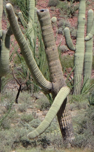
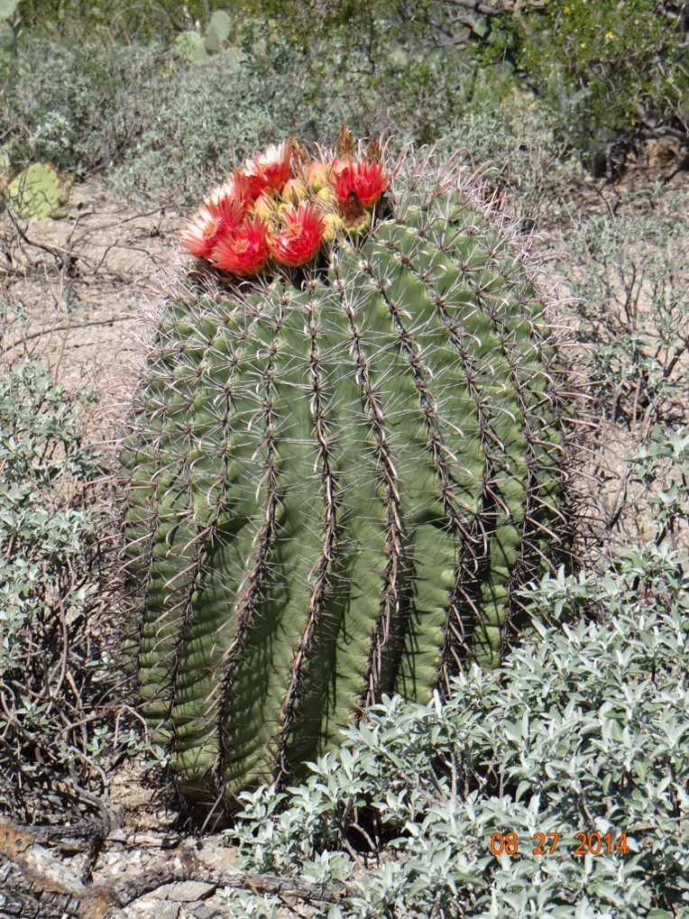
I took a ton of pretty good cactus photos around the Tucson area, but one cactus in particular caught my eye as we were driving by, and I had to stop and turn the car around and go back to photograph it.  You see, it reminds me exactly of Joan after a double martini.


After the eight days in Tucson we decided that we had had about as much fun as we can stand for one summer, and that it was time to get serious about getting back to Florida.  I’m anxious to start playing tennis again with my buddies there, and Joan is missing her music playing friends.  Therefore, our plan was to not make any more stops at parks, monuments, historical places, etc.  We knew we were going to stop for a few days in Houston to visit these new twin grand-babies, but no other stops were planned.  We left Tucson, spent a night in Van Horn, Texas and another in Junction, Texas, and then got up bright and early on Friday morning for the five hour drive to Houston.  We were really looking forward to spending a nice weekend there with our daughter’s family.

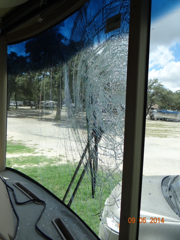
You know how when you are driving along you sometimes see birds ahead on the road cleaning up some road-kill carcass?  And you know how those birds, usually they’re buzzards of some variety, always see you coming and they fly away?  Then if you look in the rear view mirror after you pass, they just fly right back down and resume their meal.  Okay so, I’m driving the WildaBeast along on Friday morning on a country road near Johnson City, Texas (home of LBJ) heading for Houston.  I’ve got the cruise control set at about 62 mph.  I’m listening to Merle Haggard on Sirius Radio singing “Everybody’s Had the Blues Sometime”.  And I’m right there singing along with old Merle, matching him note for note, and word for word.  And sounding pretty good too, even if I do say so myself.  Just then I spot this group of 8-10 huge buzzards about a quarter of a mile ahead of me on the road.  Nothing to worry about, right?  They ALWAYS fly away.  And sure enough all but four of them immediately take off.  Now I’m about an eighth of a mile away and two more fly away.  But the other two seem to be having a disagreement over whether to leave or not.  However, one of the two decides it really is time to get going and he flies off when I am about 100 yards away.  Now I’m beginning to really bear down on that last one and I consider tapping the brake to slow down a little.  But, then I would just have to reset the cruise control again.  And besides I KNOW this last one is about to make his exit from my pathway.  And sure enough he does just at that moment.  Imagine my relief!  But then this retarded buzzard decides to fly right at the oncoming WildaBeast rather than following his buddies.  Thank goodness for safety glass, but it is shatter RESISTANT, not shatter PROOF.  WildaBeast won the battle, but did sustain some damage.  The windshield shattered and glass just blew everywhere inside the motorhome.  We finally found a place to stop and pull off of the road to clean up.  My hair, eyebrows and beard were loaded with pieces of glass.  Daisy rides on the floor between and behind our seats.  When I took her outside with me she stood there and shook herself off, and glass flew off of her like water after she swims.  We found pieces of glass clear back in the bedroom at the rear of the coach and that is almost 40 feet from the point of impact, so its amazing that none of the three of us were injured.  For now the motorhome is still in Johnson City awaiting a new windshield.  We are in Houston until the repair can be scheduled.


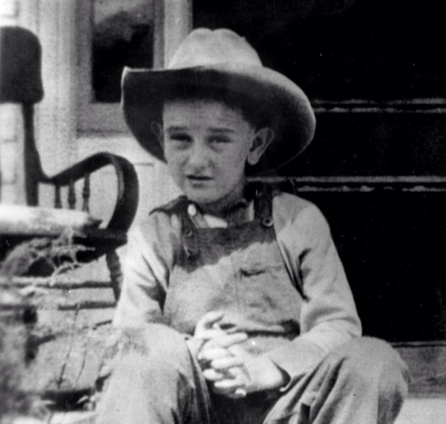
The unplanned night we spent in Johnson City did give us a chance to visit The LBJ National Historical Site.  I was never a huge fan of LBJ so we had never stopped in Johnson City even though we had driven through there at least twice before.  But with time to kill this time we did it.  I was a sophomore in high school when Johnson assumed the presidency after Kennedy’s assassination.  By then he was already an older man by my standards at that time.  Therefore, I always assumed that he grew those huge ears in adulthood.  But inside the LBJ visitor center some early photos of him as a small child proved me wrong.  I’ll bet he always had a terrific sense of hearing.


Speaking of the twins, I ran across this photo that I took of them on our last visit.  No wonder Andrew is bigger than Audrey. Blame Grandma!


The Best Laid Plans of Mice and Me

As you drive south on Highway 99 in central California Yosemite National Park is about 50 miles to the east just before you pass through Fresno.  Yosemite has entrances on both the west side of the park and on the south side.  Sequoia and Kings Canyon National Parks are about 50 miles to the east after you pass through Fresno.  We wanted to visit all three of these and Joan suggested that we camp north of Fresno, take the car to the west entrance to Yosemite, and then camp again south of Fresno and do the car trip to Sequoia and Kings Canyon.  It was my idea to set up camp only once south of Fresno, and visit all three parks from there.  I explained to Joan that this would save us the hassle of tearing down camp and setting up again, and by using the south entrance to Yosemite it would add only 15 to 20 minutes more to our trip into the park.  Because I’m really the boss of the family, plus the fact that Joan has great faith in my planning abilities we camped south of Fresno.

On the day of the trip to Yosemite we got a bright and early start, and we were expecting a ride to the park entrance of 50-60 minutes.  The park is huge and we thought it would take us all day to explore most of it by car.  Since we were going to be gone all day, and we were not expecting to do a lot of hiking we took our dog, Daisy, along with us.  Everything was fine until we got to within about 5 miles of the park entrance.  There the Highway Patrol had a road block set up due to a forest fire at the park edge.  They did not expect the road to open anytime soon, and directed us to go back a couple of miles and take an alternate route.  I expected that this would be a short detour to get us around the fire and back onto the south road into the park.  But as it turned out the detour was a road that took us all the way to western entrance to the park where Joan orginally wanted to enter.  Furthermore, it extended our trip from our planned maximum of one hour to almost three hours.  By the time we got there much of our day was shot.  And it turned out that the Highway Patrol was right because the south entrance road did not open again all day.  We ended up spending only about two hours exploring the park followed by another three hour drive back to the motorhome.

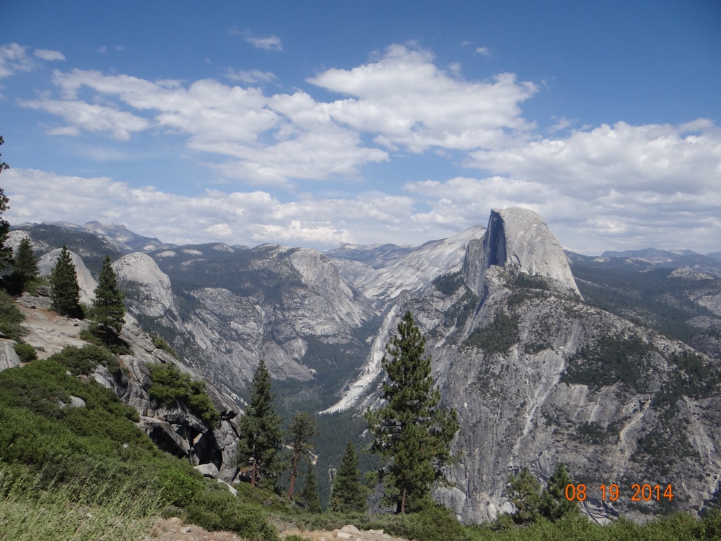
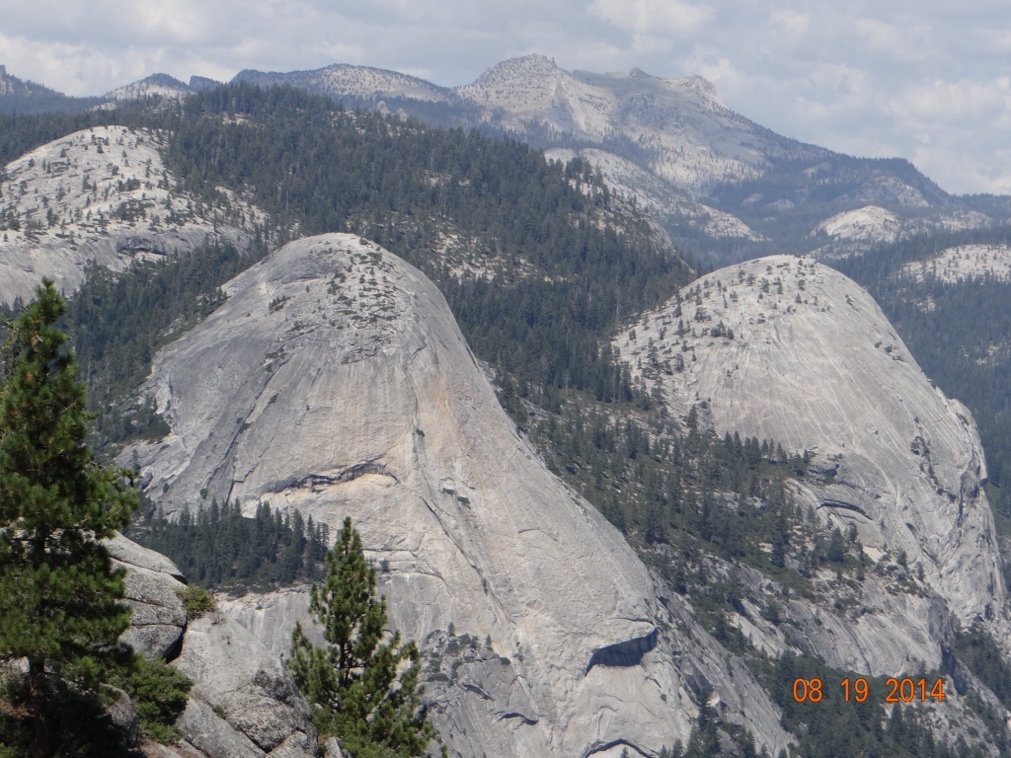
In spite of our troubles getting to and from Yosemite, and our shorter than expected stay, it was well worth visiting.  This was my third trip to the park and Joan’s second.  Unfortunately, we have never been there when the waterfalls are at their peak.  This happens in the spring or early summer and we have always been there in late summer or fall.  However, even without the added beauty of the very high waterfalls the scenery in the park is spectacular.  My favorite view is of the granite dome known as Half Dome.  It’s easy to see how they arrived at the name.


In the shadow of Half Dome are two other granite domes.  I’m sure they also have their own names, but I have not been able to determine what they are called.  So since this is MY blog and MY pictures I decided that I could name them MYSELF.  I tried to come up with some clever way to work in some reference to the female anatomy, but could not do so.  Therefore, I am just going to call these Sharon Domes in honor of my buxom friend in Kansas.

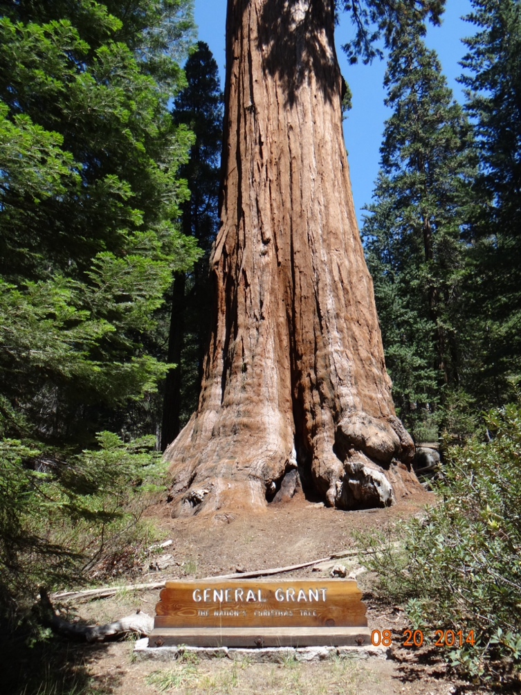
Sequioa and Kings Canyon National Parks are adjacent to each other, and therefore can be explored by car in a single day which is the way we did it.  Joan and I had been to both parks before, but never seem to tire of enjoying the majesty of the giant trees.  If you have never been to the western slopes of the Sierra Nevada mountains you have never seen Sequoia trees.  This is the only place in the whole wide world that they grow.  They are usually found at between 5,000 and 7,000 feet in elevation.  They are so big because they grow very fast and live a long life.  In fact the General Sherman tree is estimated to be 2,200 years old and it is still growing.  Every year this tree grows enough new wood to produce a 60 foot tall tree of usual size.  In general Sequoias can get to over 300 feet tall, live 3,200 years, and attain a 40 foot diameter at the base.  This longevity is made possible by chemicals in the wood and bark providing resistance to insects and fungus.  Further the thick bark (up to 31 inches thick) protects thenm from most fire.  Most of them die by actually toppling over since they have a fairly shallow root system.


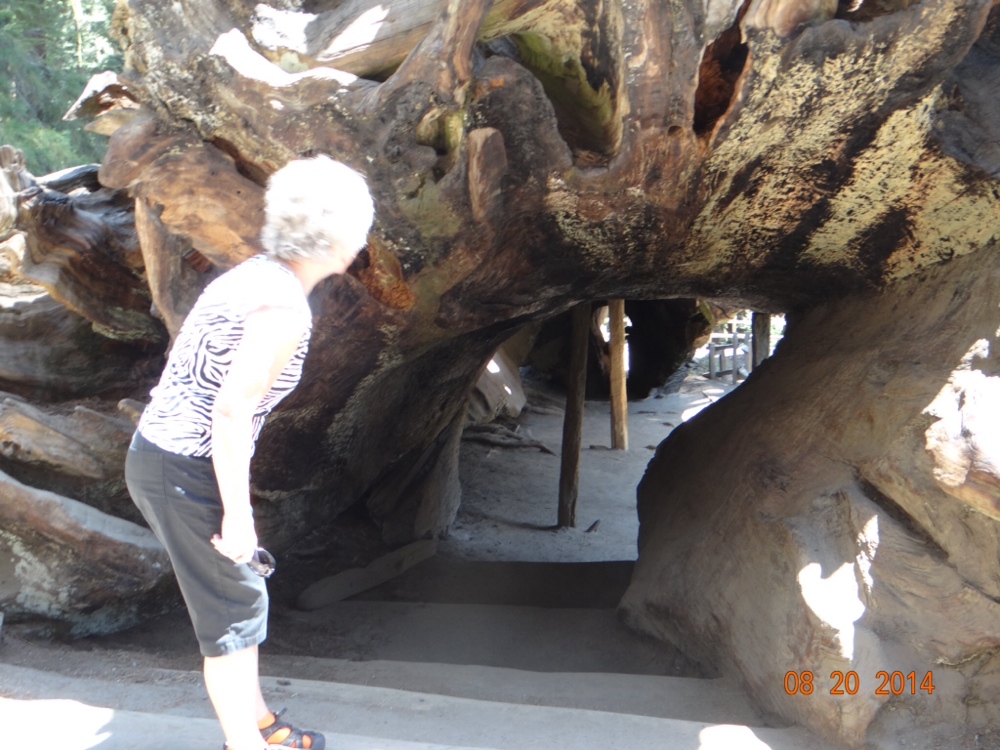
Not only do the Sequoias live a long time, but they also last a long time if toppled over.  Just beside this fallen tree that Joan is looking into I saw a placque with a photo of some people posing in front of this same downed tree that was taken in 1900.  And even though the photo was 114 years old the tree looked almost exactly as it looks today.


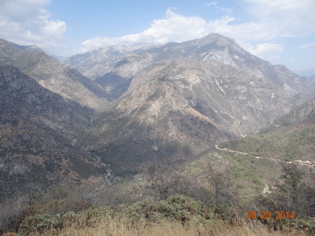
Joan and I both been to Kings Canyon previously, but had only visited it because it was next to Sequoia.  Most people have heard of the Sequoias and want to see them, so they visit Sequoia and ignore Kings Canyon.   But this time we took the time to actually drive down into the canyon.  As a result Joan has a new favorite national park.  This canyon is every bit as beautiful as the scenery in Yosemite and the actual canyon is deeper than the Grand Canyon.  And what most people fail to realize when pondering a visit to the area is that they can also actually see very impressive Sequoia trees in Kings Canyon.  In fact two of the above photos of the Sequoias were taken in Kings Canyon, and I thought the more impressive groves of trees were in Kings Canyon.  The photo below of the actual canyon simply does not do it any justice.


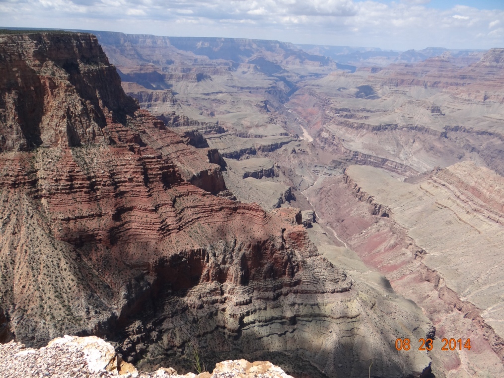
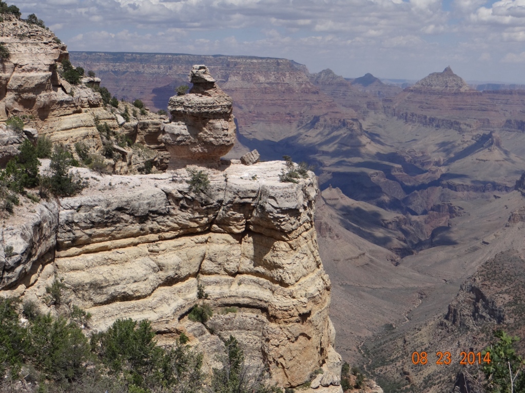
From the Fresno area we finally turned eastward and eventually entered the Mojave Desert.  Call me crazy (Joan does all the time!) but I just love the desert.  Most people say it is too brown, too dry, too hot, etc, but I always enjoy my time there. However, I will admit that I always have enjoyed it from the air conditioned comfort of my vehicle with plenty of drinks handy.  Driving east with an overnight stay in Needles, California and then on to Williams, Arizona really made me feel as though it signaled the beginning of the end of our journey.  However, just a few miles north of Williams is this little hole in the ground that we wanted to revisit.  Most people know it as the Grand Canyon.  I think this is our fourth trip to Grand Canyon National Park and it never fails to awe.  Probably lots of you have been to Grand Canyon, and you have your own memories of it, but I will include a couple of photos anyway.  Unfortunately because of the wildfires in California it was not the clearest of days when we were there.


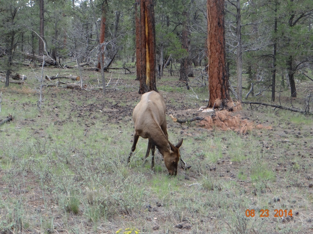
As we drive in the motorhome we both get caught up in our own thoughts along the way.  A lot of my thinking as I drive involves what I am going to say in this blog about what I am seeing at the moment.  At the beginning of our drive on the South Rim of the Grand Canyon I saw an elk crossing warning sign.  And I had the following all worked out in my mind to write in this blog:  “We have now driven the motorhome over 10,000 miles on this trip and we have driven the car at least 1,000 miles more.  In that 11,000 miles we have seen dozens if not hundreds of warning signs for elk crossings.  But we have not yet seen a single elk.  Its not that we have never seen elk before.  A few years ago we stayed overnight in Estes Park, Colorado and the elk were so thick in town that they were a real nuisance.  All of the residents had their trees and shrubs protected with chicken wire, and the bugling was so loud at night that we could not sleep.  But on this trip we have been in elk country for months and Grand Canyon is probably the very last likely spot that we could actually encounter an elk before we get back home in Florida.”  Okay, that’s what I was going to write, but now I’m not.  And here’s the reason.

Just as we were leaving the national park we spotted this puny little guy (or girl) beside the road.  No rack, it wouldn’t even look up at us for a photo op, and it ruined my opportunity to whine about not seeing any elk.

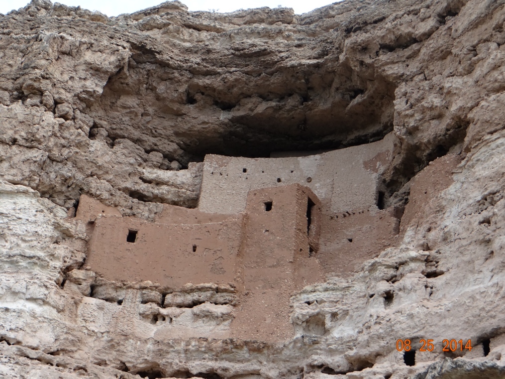
From Williams and the Grand Canyon we moved just a few miles south to Camp Verde, Arizona, and spent two days visiting our friend Edna.  She informed me that she is not actually 150 years old as I wrote in the previous post, but just had her 88th birthday.  While in Camp Verde we also visited the Montezuma’s Castle National Monument and Tuzigoot National Monument (all of the weird names for places don’t come from Washington State).  These are both ancient Indian ruins and the castle is especially well preserved and was built right into the side of a cliff.


At Tuzigoot I could not resist buying myself a new hat to go with my newly longer and bushier beard.  I like my new look for places with names such as Deadwood or Tombstone. Or even El Paso.  It probably is not the best look for the beach, but we’ll see.


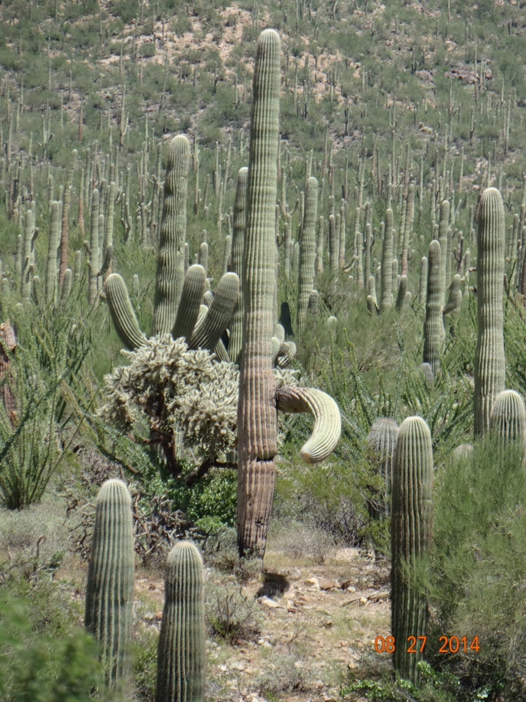
 From Camp Verde we moved on to Tucson, Arizona which is where I am writing this from.  Tucson is one of my favorite little cities.  I mentioned earlier how much I like the desert and Tucson lies right in the Sonoran Desert.  We are spending eight nights in Tucson and getting a few minor repairs done on little problems that have cropped up after living in the motorhome for four months.  Just outside of the city we have visited the eastern and western sections of Saguaro National Park.  It’s not the best time of year to catch the cactus in bloom, but the variety of cacti all in one place make it interesting and there are a few that are presently in bloom such as the Barrel Cactus.

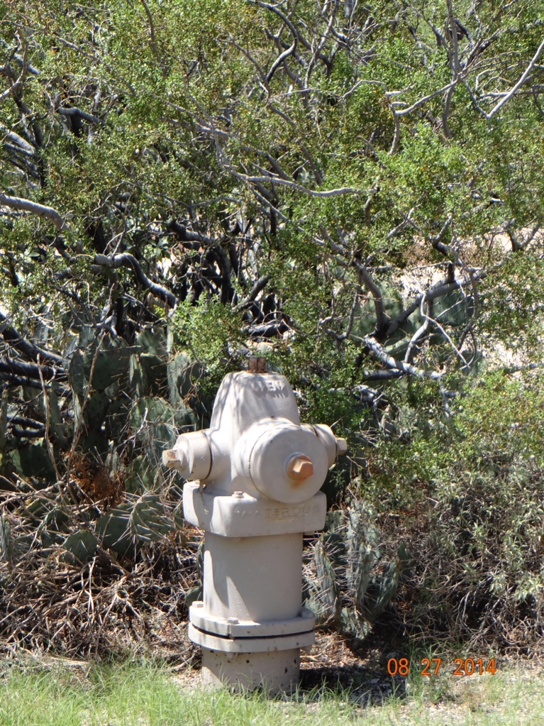
You never know what kind of cactus you might spot in the area.  For instance just outside of the visitor center for the park I spotted this perfect example of the non-prickly common fire plug cactus.  Note the unusual coloring of this example though.


I’m especially fond of the Saguaro.  They do not live as long as the Sequoias, but still the mature Saguaro can be 250 years old.  And in the national park here they are everywhere.


If you have ever wondered why a few of the Saguaro have a downturned arm such as the one in the above photo, it is my understanding that this means that at some point in their long lives they have been exposed to a freeze.  Since I’ve always been here in the summer I don’t think of it being cold and freezing in Tucson, but I guess it does happen.  

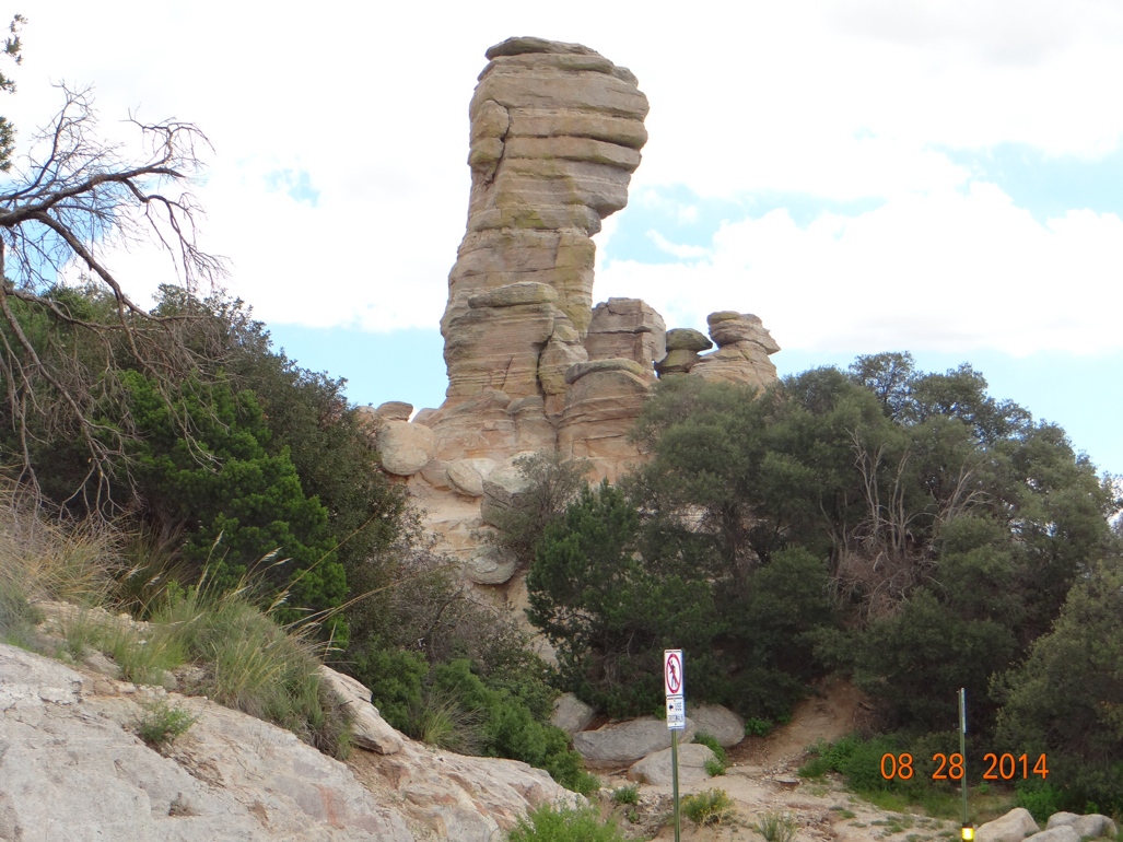
Another phenomenon that appeals to me about the Tucson area is the varied climate around the city.  Yesterday it was 100 degrees in the city which sits in a valley.  Just forty miles outside of town we drove up to Mount Lemmon, a popular winter skiing area.  Mount Lemmon sits at 8,000 feet elevation.  As you drive out of the city you drive through a virtual forest of Saguaro until you reach about 4,000 feet.  At that point the Saguaro disappear and are replaced by high desert plants such as Creosote bushes.  Then as you continue to climb toward 8,000 feet you enter a pine forest and you would think you are now in a northern locale.  Yesterday when we reached the summit it was 63 degrees.  As we drove back down the mountain the temperature climbed steadily, but it was no longer in the triple digits upon arrival in the valley.  It had dropped to a more reasonable 98 degrees.  Much better!!


From Tucson I am expecting us to pretty much make a beeline to Houston.  Joan thought we would be there for the August 6 first birthday of the twin grandbabies, Audrey and Andrew.  Obviously, we did not make that! We are getting anxious to see them.  For my Florida friends who were concerned about Audrey’s eating problems in her earlier months, be advised that she is now doing fine.  She and Andrew are both walking now.

Washington, I Cannot Tell a Lie!

The truth is that the State of Washington has some very spectacular scenery.  And Oregon’s not so bad either.  Today marks two weeks since we re-entered the lower 48 and we have been mostly just kicking around in those two states.  Not making much progress so far on our march back to Florida.  However, we did cross into California yesterday and are now in Hat Creek, California.  But before I get into that let me tell you about the big cat that I saw in British Columbia and forgot to mention in my previous post.

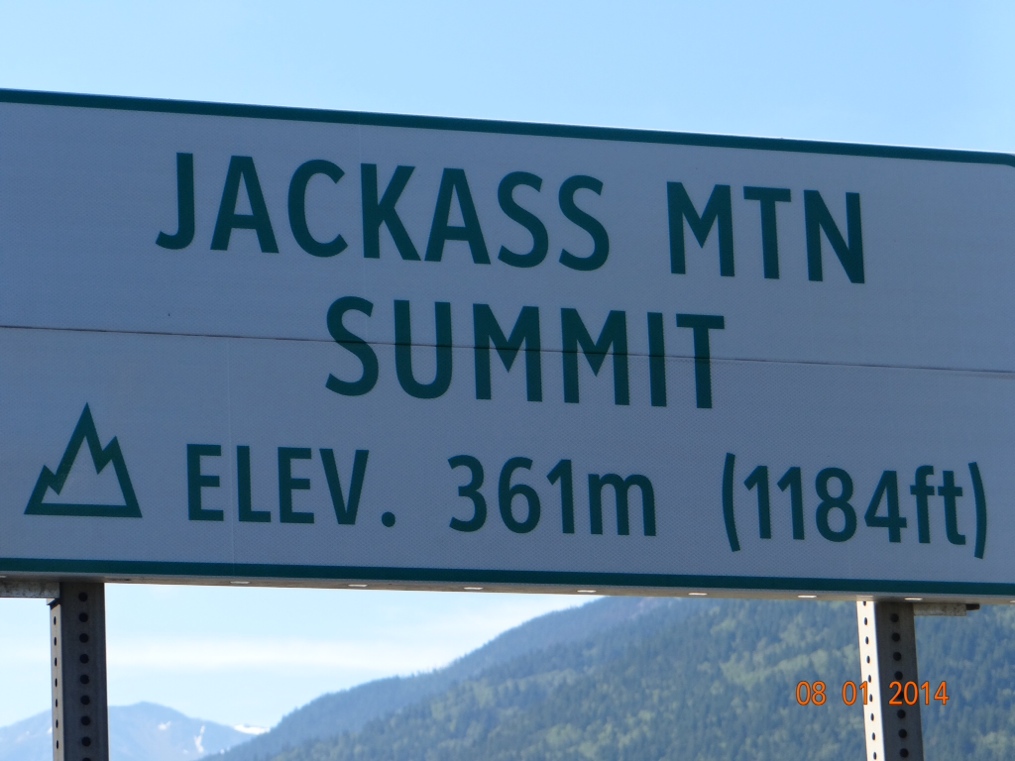
Somewhere near Jackass Mountain (love that name!) we were following another motorhome down the highway and a huge cat crossed the road in front of the other motorhome.  So it was a fleeting glimpse of the cat for me and Joan did not see it at all.  But it looked to be slightly bigger than our Border Collie, Daisy and she is sixty pounds.  My subsequent research tells me that there are only three varieties of wild cats in BC.  Bobcats, Cougars and Lynx.  This cat appeared to be black and had a long tail.  So that ruled out the Bobcat.  And from what I have been able to read only the Lynx sometimes is dark enough in color that it appears to be black.  So I’m guessing that is what I saw.

When we crossed into Washington from BC we chose Bellingham as our first base of operations.  This is a little city about fifty miles north of Seattle.  I expected it to be a sleepy little place, but was wrong.  I don’t know the exact demographics of the Seattle area, but I suspect it is a very young population.  And while we were there it seemed that everyone was headed out in their SUV’s and minivans with the “Baby on Board” signs.  Probably those soccer moms dropping the kids off, but in any event the place was just way too busy for us.  Adding to the mayhem in the area was the fact that it also was a long weekend for British Columbia.  Every campground was full and we ended up dry camping in the parking lot of a casino for the long weekend.  Dry camping means that we had no electric, water or sewer hookups.  That’s not as bad as it sounds because we have water and sewer storage on board and we can operate on generator and/or battery power for quite a while.  But three days in the parking lot was plenty for us.

We thought Bellingham would give us easy access for a car trip to North Cascades National Park.  It was about 85 miles to the east of us.  The west side of the park is very nice with some beautiful mountain vistas.  This is where we entered and probably since we had just toured all around gorgeous Alaska and driven down through spectacular BC we were not quite as taken with the park as we would otherwise have been.  But we did read that the most beautiful part of the park was another 60 miles east.  Since we had already planned on “only” a 170 mile drive we did not want to add another 120 miles to our day trip.  We chose to save that part of the park for a future trip out this way.

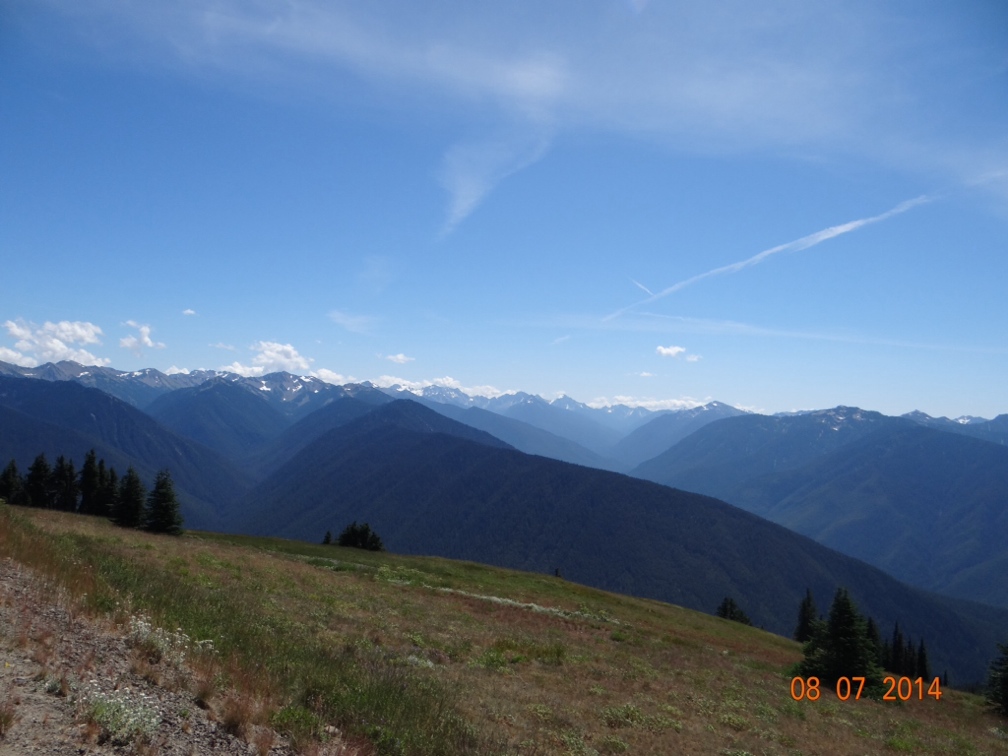
From Bellingham we drove down through Seattle and Tacoma and camped in another casino.  However, this one had an actual campground with full hookups for us and it gave us access to Olympic National Park.  We did this park again by car and again ran short on time and only got to see the eastern and northern sides of the park.  The road is essentially a loop around the outside of the park with periodic roads going into the park interior.  The park is on a peninsula that juts up between the Pacific Ocean and Puget Sound.  The parts we saw were fantastic and I’m betting the ocean side on the west would be just as great.  The views from Hurricane Ridge which we drove into on the north side were well worth the trip.


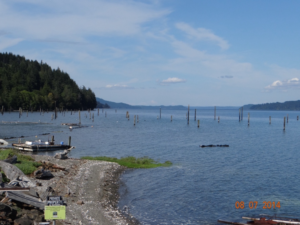
Driving back from Olympic NP we made a fascinating discovery.  Have you ever wondered where fence posts come from?  I mean its not like they grow on trees you know.  But right here alongside the road in  western Washington we found this fence post farm.  I never knew they grew them in salt water.


Joan and I have driven around on the Washington and Oregon coastline on two previous trips out here.  The Pacific Coast Highway is a beautiful drive from Seattle all the way down through California, but when heading south on that road you encounter many places where it seems you are driving right on the edge of a 300 foot cliff above the ocean.  That sometimes makes me uneasy in the car, so I had real reservations about making the drive in the motorhome.  Therefore, we decided to take a more inland route south.  This also afforded us the opportunity to visit Mount Ranier National Park one day and then Mount Saint Helens the next day.  Both are old volcanoes and are spectacular, but in totally different ways.  Mount Ranier because of the natural beauty and Mount Saint Helens because of the devastation that is still so apparent almost 35 years after it last exploded.

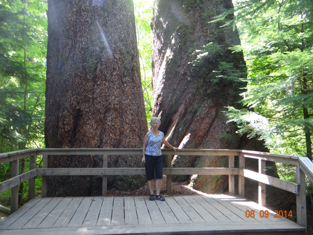
On the way up toward the top of Mount Ranier we stopped to do a hike to a grove of huge trees called Grove of the Patriarchs.  Mount Ranier and the other tall peaks in the area trap much of the moisture coming off of the Pacific and don’t allow it to go further east.  This makes for rain forest-like conditions in places and is evidently very beneficial for growing huge trees.  These trees that we hiked to I think are the biggest trees I have ever seen that are not Redwoods or Sequoias.  The one on the left is a Douglas Fir and the right one is a Cedar tree.  These were just two examples of several very very large trees here.

I could not have said for sure what kind of trees those were, had I not read a placque about them.  I’m sharp enough to know there is a huge variety out here of what I generally call ‘”pine trees”.  This is where it would be nice to have my friend Doug, the retired Saluki forestry professor, along on the trip to keep me straight.  I can usually pick out tamarack, hemlock and cedar.  Otherwise if it has needles where leaves would normally be I call it a pine tree.   Having said that I should add that I can also identify a Christmas tree (the balls and lights do it for me).

Speaking of hikes, Joan likes to make me stop frequently and head off on some path that she has read about.  I figured we would be doing a lot of this in Alaska.  And since the tallest peak in North America is there I thought we might be hiking at high elevations.  I bought an app for my phone to tell me the elevation so I would have an idea of how winded I might get.  Its a cool app because it gives not only the elevation, but also the latitude and longitude and the boiling point of water at that elevation.  Now that last feature is extremely useful, because I’m often overcome on these walks with the urge to gather sticks, build a fire and boil some water.  So its very convenient to know how long this will take.

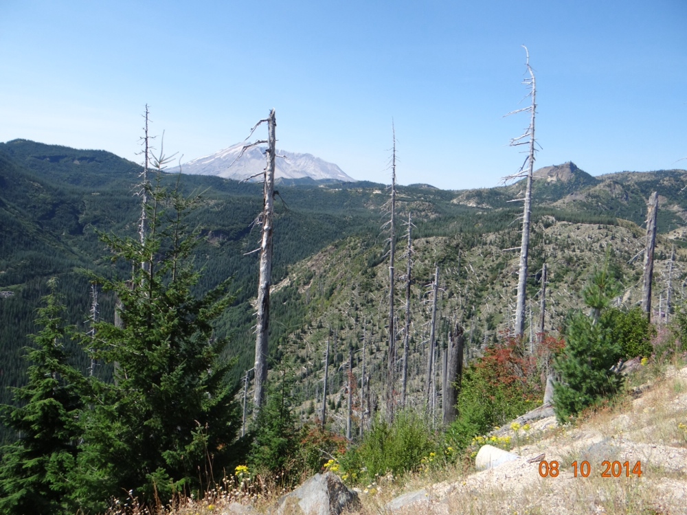
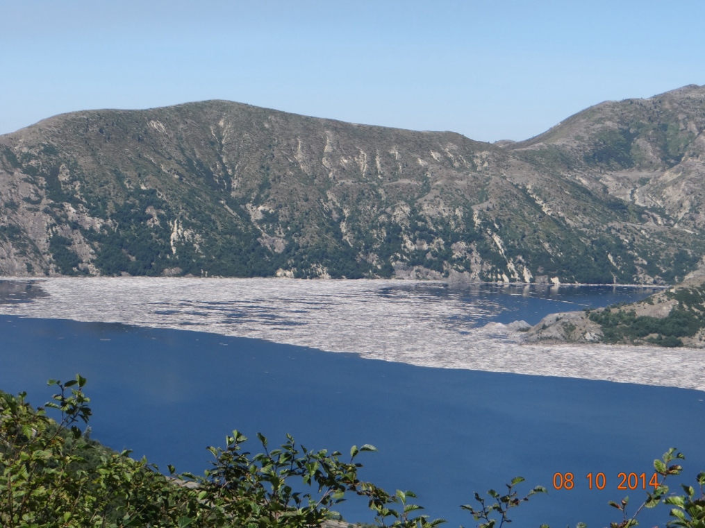
For miles around Mt St Helens the devastation is just unbelievable.  Almost every mountainside facing the site of the explosion is covered with either still standing dead trees or the ground is covered with huge logs all laying facing the same direction as if swept over by some huge hand.  The shot below was taken at a distance of about fifteen miles from the mountain in the background and the biggest trees are dead.  One very large lake in the area is almost half covered with floating logs from the explosion.  All of the grey area on the water in the lake photo below is dead logs floating on the water.   It is interesting that in the areas where the dead trees are still standing the undergrowth on the ground is thriving as if nothing had ever happened.  The reason for this is that the actual explosion took place on May 1, 1980 and at that time there was still eight feet of snow on the ground.  The searing heat from the blast immediately killed the tall trees, but the snow blanket protected everything underneath.


From our campsite at the base of Ranier we drove east through White Pass before turning south into Oregon.  Within about fifty miles on this road we had passed from the rain forest conditions to a countryside around Yakima that very much resembled what I would expect to see in Arizona, New Mexico or West Texas.  Sage brush, tumbleweeds, etc.

Before we leave Washington I want to comment on some of the unusual names we ran across.  In the Olympic peninsula we saw the towns of Duckabush and Dosewallips.  And then there are the towns who use the same word twice–Hamma Hamma and Wis Wis.  Its as if you didn’t hear it the first time so we’ll repeat it.  And although not a town, I saw a road called Kitchen Dick Road.  I’ll not even speculate on where that came from.  Oh, and speaking of two word towns, there is Walla Walla.  There seems to be a movement among the Walla Wallans to claim that the onion was invented there.  Sweet onions are everywhere there, but I thought it was settled history that the onion was actually invented on the island of Bermuda by Thomas Edison while he was on vacation there.  He was fresh off of having invented the light bulb, thus the similarity in the shape of the onion and the light bulb.  Then I believe he sold the manufacturing rights to Henry Ford and Henry automated the process at his plant in Vidalia, Georgia. Washington is better known for its production of apples and to a lesser extent cherries.  And we all know it was just south of here that Steve Jobs invented the Apple.

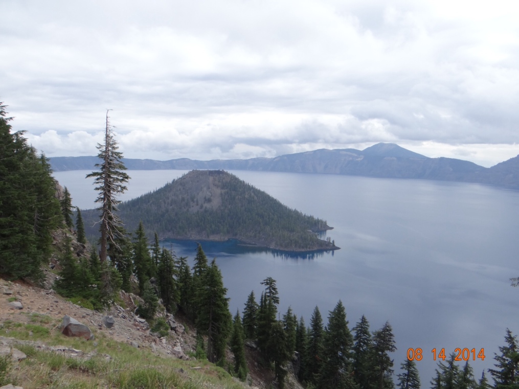
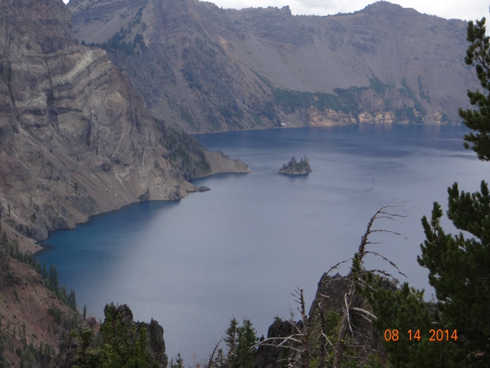
From Washington we crossed over the Columbia River and headed down through the center of Oregon eventually landing near Crater Lake National Park.  Crater Lake is a little out of the way, but very much worth the trip.  It is the deepest lake in the USA at over 1,900 feet deep.  No matter how tall you are that’s pretty deep.  It also holds the record for water clarity.  Joan read that normally you can see an object down over forty feet in the water, but when conditions are just right you can see down over eighty feet.  The reason that the water is so clear is that no streams or rivers drain into the lake.  All of the water in it is from either rain or snow melt.  The road that loops all the way around the rim is about 35 miles long.  We drove about 32 miles of that and then because of construction repairs the road was closed, necessitating a 32 mile trip back over what we had just traveled.  But the scenery along the drive was well worth seeing twice.  Unfortunately we had an overcast sky that day and the photo ops were not what we had hoped for.  The island in the lake is the top of a volcano and is known as Wizard Island because it supposedly resembles the top of a wizard’s hat.


This smaller island is further around the rim of the lake and is known as Phantom Ship.  Also note the multi-colored rock on the left side of the picture.  The blue water in the lake is not a trick of the camera, but rather really is a very vivid blue.

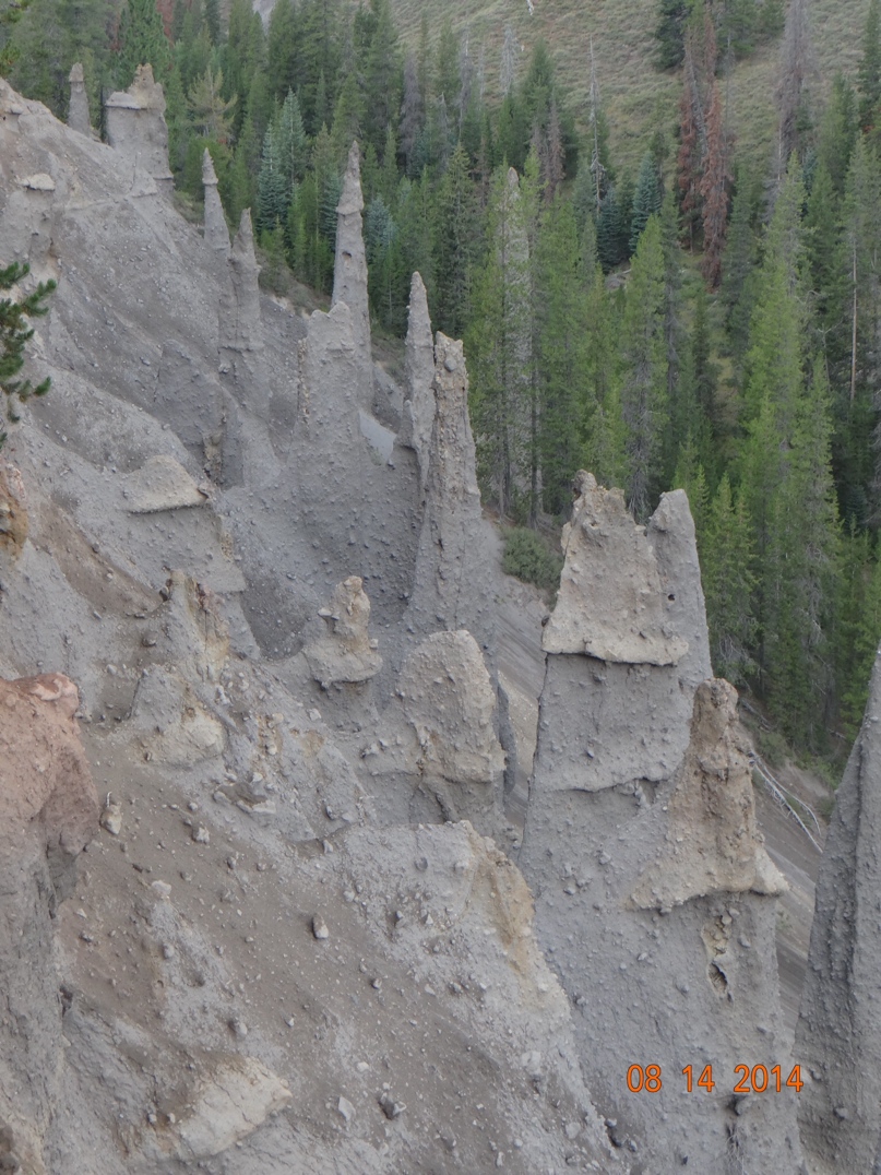
Also at Crater Lake are these natural features known as the Pinnacles.  They were formed from volcanic gases bubbling up through volcanic ash and cementing the ash into solid rock.  Some are hollow in the middle where the gases were.


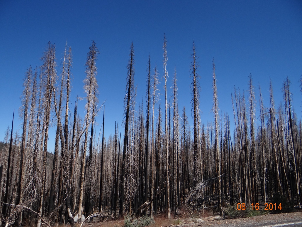
What brought us to this area of Northern California is another Volcanic National Park, Lassen.  We hesitated to come to this area because it is the immediate area where the California wild fires have been raging.  But the campground operator assured us that the fires were out and the area was now green.  And that was true as long as you have a limited view of what “area” means.   To get here we drove through miles of burned out forest and then about a mile from the campground the fire area did end.  


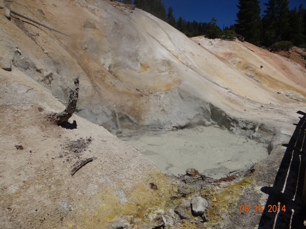
But Lassen National Park itself was well worth the trip.  Lassen Peak last erupted in 1915 and along the road through the park you can still see mudpots and fumaroles bubbling up steam and sulphur gases much like are in evidence in Yellowstone.  The churning and bubbling does not show up real well in the photo below, but it is going on and the smell is a very strong rotten egg odor.   In my younger days of frequenting the local taverns, shooting pool with my buddies Dave, Fred and Phil, drinking beer and eating pickled eggs from a jar on the bar, I could have been described as somewhat of a fumarole myself I guess.

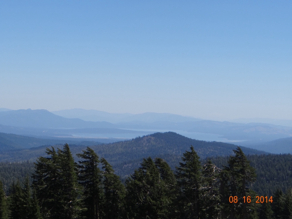
Because of the high elevation (8,500 feet) there is a very nice view of Lake Shasta about fifty miles distant.  Note the haze in the air though lingering from the fires.  This is not from high humidity, but rather is smoke.


I have an old friend, Edna Simpson.  I say OLD because Edna has to be approaching her 150th birthday by now.  But she still lives in her own home by herself, and she is still sharp as a tack and sends me lots of good jokes and stories.   After my previous blog post Edna took the time to write to me, and let me know that Les Moore (who was shot six times with a 44) is actually buried in the state of Arizona where Edna lives, not in western Kansas as I had thought.  I stand corrected, Edna! Thanks.

Mishmash

I am writing this from Bellingham, Washington.  The trip here from Tok, Alaska was long, but pretty much uneventful.  Actually, unless you have driven to Alaska, I don’t see how you could really have any idea of how very very far away from the rest of the USA that Alaska is.  We left Tok on Sunday and arrived in the state of Washington on Friday.  Friday was a somewhat shorter driving day than the others in which we spent eight to ten hours on the road each day.

We stopped in Clinton, British Columbia for our last night in Canada.  I hesitated to spend a night in a town called Clinton, but decided it probably was in no way related to Billary (or even the little Clinton) so we went for it.  And in the small world category it turned out that the guy running the campground grew up in Mouth of Seneca, West Virginia which is right down the road from where I grew up in Elkins, West Virginia.

In that five days of driving the only cities of any size that we encountered were Whitehorse in the Yukon Territory, and  Prince George, British Columbia.  Prince George is actually named after my friend George Griffith because he is such a prince of a guy.  And the most interesting landmark that we came across was Jackass Mountain Summit, which is also named in honor of my friend George Griffith because…………………………..
 

As I wrote the previous posts to this blog from Alaska I had many observations and random thoughts on the Alaska portion of the journey that I was unable to work in anywhere.  So, the following will be a kind of synopsis of those.

People have asked Joan and me how we stand spending so much time together in the relatively small area of the motorhome.    I drive and she reads/studies.  And we have lively discussions at times.  It used to be that when we were going to take a long car trip we would contact AAA to map a suggested route for us and prepare a “Triptik”, which is a summary of interesting features to be encountered along the way.  As I was driving Joan would read to me some interesting tidbit of information about whatever it may be that we were seeing along the road at that point in the trip.  For this Alaska trip we did not use AAA, but we did purchase The Milepost.  That is a book about an inch and a half thick that describes in great detail every possible thing that you will see at each mile along the road to Alaska.  It makes no difference which road you might take.  The Milepost has them all covered.  It is like the mother of all Triptiks!   And I think Joan has read it from cover to cover.  She is a wealth of information.

At some point along the way Joan explained to me why the Alaska Highway was constructed.  It was built in the early 1940’s during WWII because we were worried about the Japanese invading Alaska.  She added that we were concerned because Alaska is so close to Japan.  Prior to her saying that I had never thought of Alaska and Japan as being close to each other. But somewhere in Alaska I saw one of those signposts with distances to various places and it indicated that Tokyo was 3,500 miles away and Miami was 5,500 miles away.

I noted in a previous post how the long summer days in Alaska are conducive to growing fruits and vegetables.  The long days evidently are ideal for wildflowers as well.  The state is covered with them.  Especially two varieties, Fireweed and Cowslips.  They are everywhere.  Cowslips remind me of a flower that we had back east in PA and WV known as Queen Anne’s Lace except Cowslips are bigger.  Fireweed is a purple cylindrical shaped flower that seems to be the very first thing to grow back after a forest fire.  And we went through many vast areas that had burned.
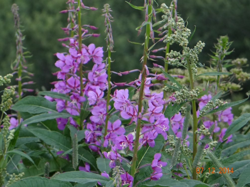


I mentioned our lively discussions.  Joan has this exceptional way of saying certain words.  Or maybe its me that has the exceptional pronunciation.  Where I would say FIREweed she would say fireWEED.  Or we can kill some time by discussing if its “cow’s lips” or if “cow slips” is correct.  I guess this is the kind of thing you talk about after traveling around together for 45 years and you get tired of listening to Willie’s Road House on Sirius Radio.

Fairbanks was as far north as we went in Alaska, so I tend to think of that as being in the northern part of the state.  We chose to stop our northward trek there because that’s essentially as far as the paved road goes.  But in reality Fairbanks is not really that far north in Alaska.  I think the road actually goes another 800-900 miles north from there.  But Fairbanks is still up there.  It sits at about the 65th parallel or 65 degrees north.  For perspective Seattle is only at about 48 degrees north, which means that Fairbanks is over 1,200 miles farther north than Seattle.  Where I live in Ponce Inlet, Florida is only at 29 degrees north.  So Fairbanks is 2,500 miles farther north.  No wonder it was only 37 degrees Fahrenheit and raining when we got there in late June.  

So where the paved road ends going north out of Fairbanks has to be the northernmost paved road in the USA.  When we drove down to Homer, Alaska on the Kenai Peninsula Joan’s research told us that just outside of Homer we were driving on the westernmost continuous highway in North America.  There are roads that are more western out in Nome and the island portions of Alaska, but you cannot drive to them and must be ferried there so they are not continuous.

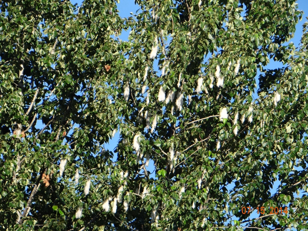
I’ve seen Cottonwood trees before in the southwest and midwest.  But I never knew why they were called Cottonwood.  Just never had thought about it.  But when we drove into Fairbanks it was cold and wet enough that I actually considered that it might snow.  And as we approaached our campground I was convinced that it was indeed snowing.  The white stuff was everywhere in the air.  But I soon learned that the female Cottonwood trees were going to seed and it did look just like a snow storm.  I guess the male trees don’t make any messes.  Unlike in our house (or so I’m frequently told!).


When we first started talking back in Florida about a trip to Alaska, Joan was hopeful that we would see the Northern Lights.  We lived in southern Ontario for two years and have been back in Ontario several times on camping trips.  And even though it is possible to see them where we were, neither of us have ever had the pleasure.  But we soon learned that in Alaska we were going to be there at the wrong time because of the long days.  So while in Anchorage Joan drug me to a movie about the northern lights.  And that was after having a 10% alcohol beer and a heavy fish and chips lunch at Humpy’s across the street from the theater.  It was a forty minute movie that was just pictures of the lights with soft music playing.  After five minutes I had had enough of that, and I was not the only one in the theatre who had to fight to stay awake.  Heads were bobbing everywhere around me.

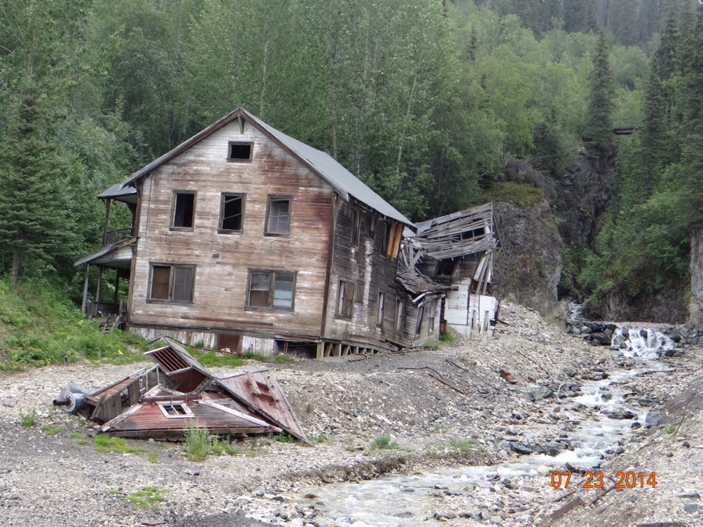
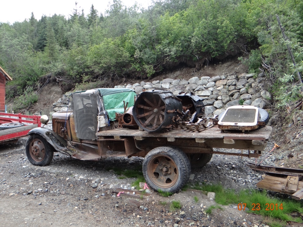
Oftentimes when we travel to a new area that we like, we think of buying property there.  Maybe not for full time living, but as a second or seasonal home.  In Kennecott I got caught up in this thinking and could not resist buying a house.  It’s a bit of a fixer upper, but I used my expertly honed negotiating skills to get a fantastic price and talked them in to throwing in a really nice pick up truck.
 

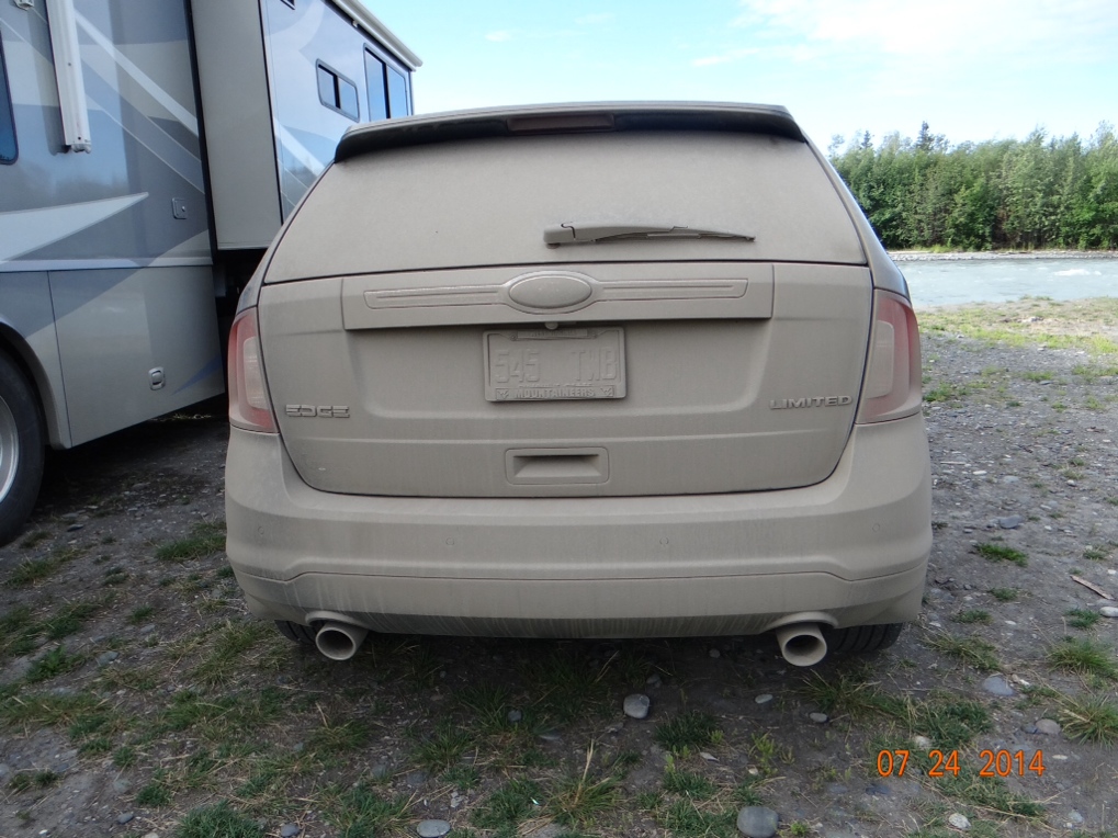
I think I have previously described how bad the 60 mile long dirt road to Kennecott was.  I’m not very good about washing cars.  I had a Toyota Tundra pickup that I bought in 2002 when we were renovating our West Virginia farmhouse.  It was never washed, not even once, until 2008 when I decided to trade it.  I stopped just before the car dealership and washed off the six years of dirt.  That worked okay in WV, but even I had to break down and wash our gray car after driving it to Kennecott and back.  Amazing how dirty a car can get on 130 miles of dirt road.


The area where I am sitting now in Washington is noted for its coffee.  After all, this is where Starbucks came from and there is also something called Seattle’s Best.  But nowhere that we have been have we seen coffee shops like we saw in Alaska.  Starbucks is probably up there in the cities, but I didn’t see any.  What I did see plenty of are little Espresso and Latte shops. We drove past dozens of them every day that we moved.  Most were tiny tiny operations that looked like someone had taken a four foot by eight foot storage shed, set it up in a gravel parking lot or just beside the road, hand painted a sign and started selling coffee out of the shed.  I guess its a cheap operation to start up, so no barrier to entry into the business.  And if the business fails you have a good shed for the snow blower come winter.  Assuming that they are year-round operations my theory is that the Alaskans need to drink that stuff to stay warm and awake during that long, cold and dark winter.

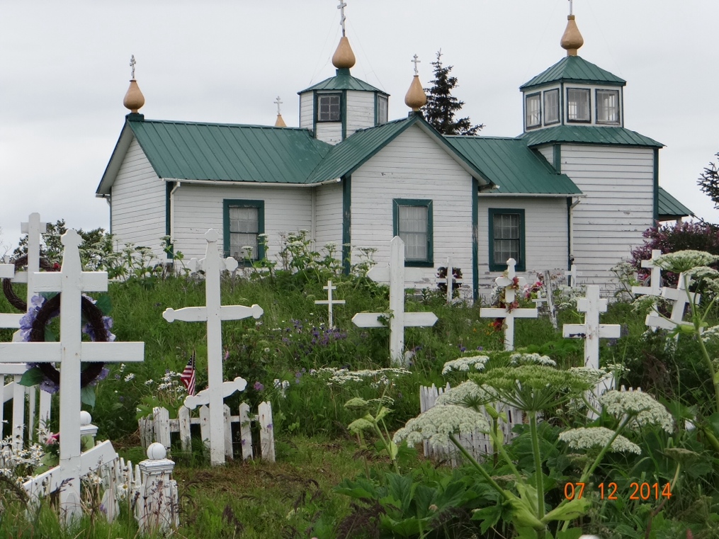
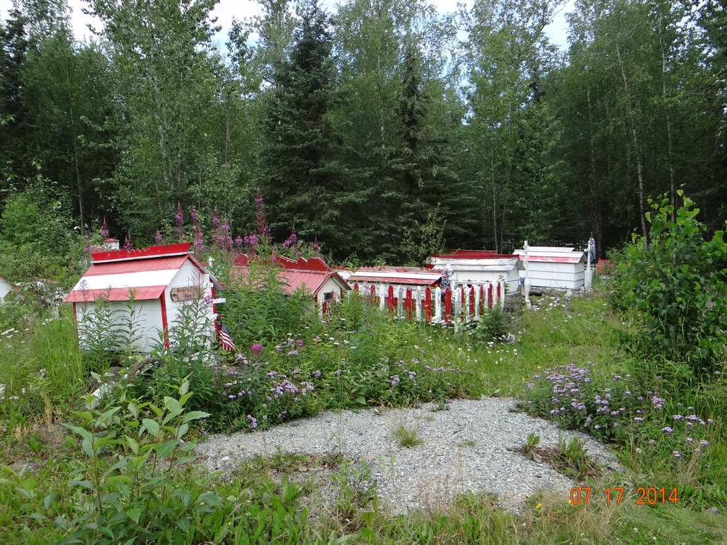
In addition to an inordinate number of espresso shops Alaska also has lots of Russian Orthodox churches, most with a cemetary all around it.  And some of the cemetaries of native Athabascans influenced by the Russians frequently have what they call “spirit houses” covering the actual gravesite.  These were built by family members to house the spirit of the deceased rather than have them reside in the heavens.  The Russian influence from years past too probably explains the huge number of those little Russian dolls that fit inside each other that are found in so many gift shops throughout the state.


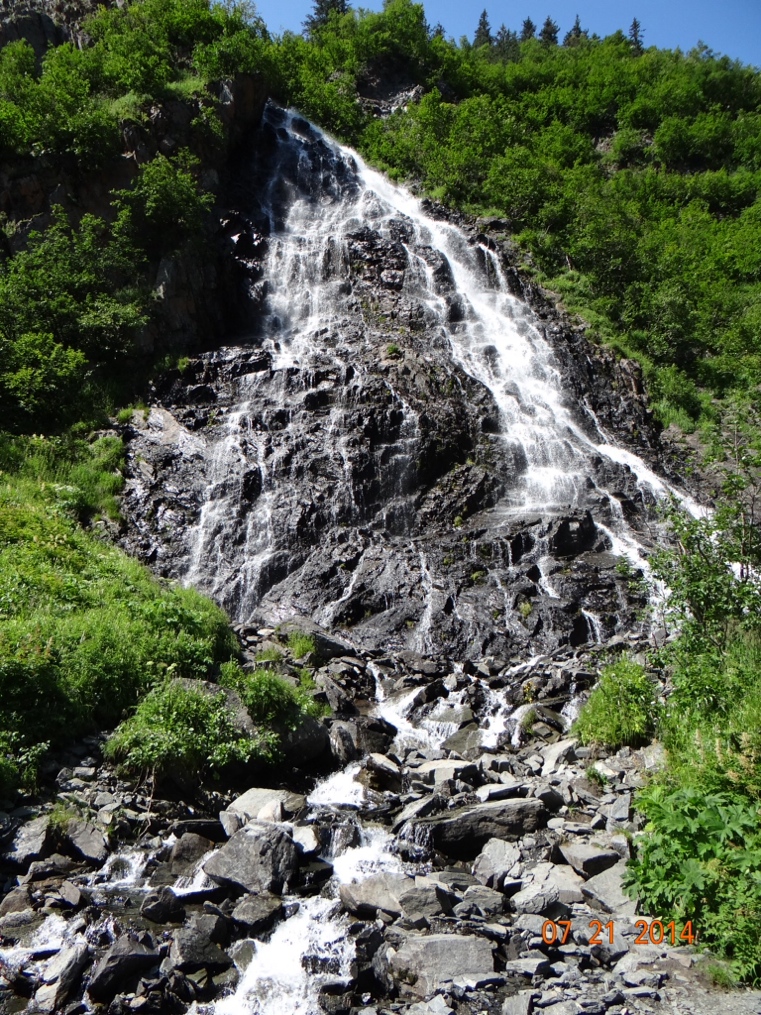
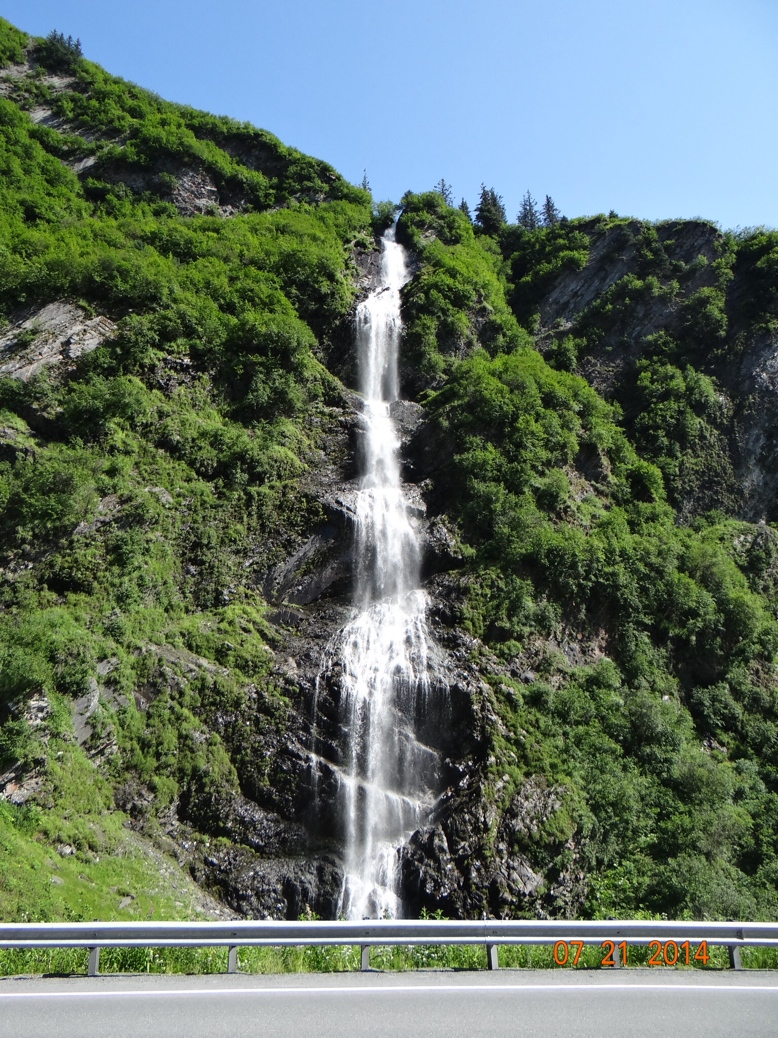
With so many snow covered mountains waterfalls are in abundance in Alaska.  At first we were snapping pictures of every little stream we saw falling down a mountain.  But later we became more discriminating.  Two of my favorites were just outside of Valdez—Bridal Veil Falls, and Horse Tail Falls.  As usual the photos do not do them justice.
 

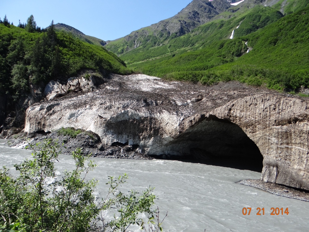
The most unique site we came across was also just outside of Valdez.  The end of a glacier hanging on the mountain actually had a river running through it to form an ice cave.


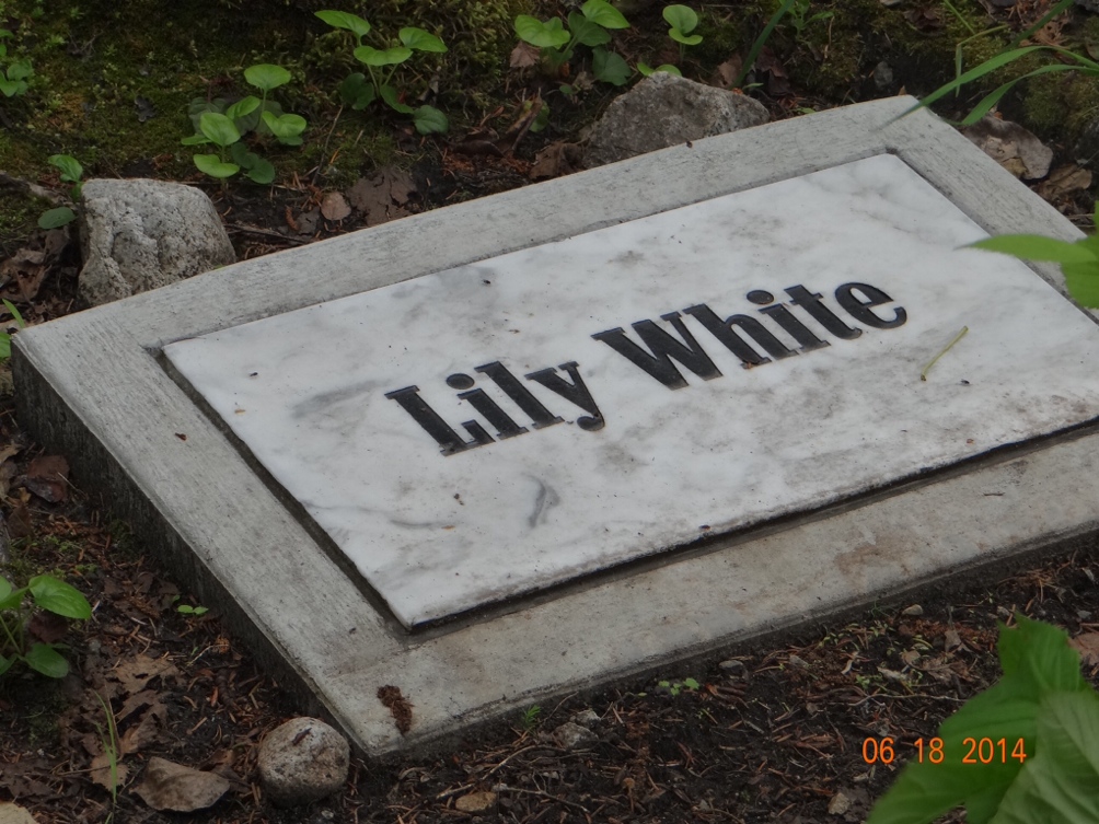
I guess maybe I’m strange, but I do enjoy looking at old cemetaries.  Just a short walk out of downtown Skagway is an interesting cemetary housing mostly the graves of those who died in the late 1890’s trying to get up the pass through the mountains to stake a claim in the Klondike Gold Rush.  That is where I saw the grave of Lilly White.  I have no idea who old Lilly was, but I liked the name.  And the grave reminded me of one I saw somewhere in western Kansas (I think) several years ago.  The epitaph there was “Here Lies Les Moore.  Shot Six Times With a 44.  No Less, No More.”
 

My biggest regret on the trip was that I did not go out on a fishing charter for halibut.  I waited until our last city, Valdez, to look into it, and I could not find one shorter than 12 hours.  I can’t do anything for 12 hours these days.  But I almost went anyway because I was afraid if I didn’t go Joan would drag me into another museum.  Every little town has one, and Valdez actually had two.  They’re mostly all the same, and like with the black bears along the road, after 50 or so I’d seen enough arrowheads, Indian headdresses and casts of grizzly bear footprints to do me.  But Joan let me off the hook, and went to both museums by herself.

And finally, in the category of really cool names—we saw a gift shop in Homer, Alaska that was called Homer Sapiens.  We didn’t go in, so we don’t know what they were selling, but with a name like that it had to be good stuff.


Turn Out the Lights, The Party’s Over

In the previously published version the pictures did not upload for some reason.  I’ll assume it was operator error.  Anyway they should appear in this version.


Dandy Don Meredith used to sing that in the very early days of Monday Night Football toward the end of the game or when it looked like a victory was in hand for one team or the other. However, in this case, it appears that the Alaska portion of our vacation is about to end. I am writing this from Tok (pronounced “toke”, not “tock”) which is on the Alaska Highway and one of the first towns we visited in Alaska. I don’t think I have mentioned Tok before and I won’t really say much about it now either except that that’s where we are. The reason is that there’s really nothing to say about it. Everyone who drives to Alaska comes through here because they have to. The town consists of four or five RV parks, a couple of gas stations and a restaurant or two. Nothing too exciting, and the plan is to leave here tomorrow morning headed back into Canada for the long trip to the lower 48.

When we were in Tok about a month ago we had to make a decision on which way to go out of Tok. The highway system in Alaska essentially makes a big circle and from Tok we could continue heading northwest toward Fairbanks or we could have headed southwest toward Anchorage. Since it was fairly early in the season I wanted to go toward Anchorage in the south and give the Fairbanks area in the north more chance to warm up. Joan voted to go toward Fairbanks and then to Denali National Park because she thought Denali would get more crowded as the season progressed. I don’t always win these disagreements and this was one of those times. However, as it turned out, I’m glad we went the way we did, but not because of weather nor overcrowding. I’m of the opinion that the best sights and scenery are in southern Alaska, not the interior portion where Fairbanks is. Had we seen all of the best “stuff” first and then headed up toward Fairbanks I don’t think we would have appreciated that part nearly as much.

From Soldotna where I wrote the previous post, we did a day trip in the car down to Homer on the coast. Homer is a little fishing village surrounded by glaciers which are highly visible as you begin to drop down out of the mountains and head into town. The interesting geological feature of Homer is what is called the Homer Spit. It is a very narrow spit of land that extends out into the bay for about a mile. The spit itself is covered with RV parks, saloons and the typical tourist gift shops. The harbor is behind the spit in the protected waters, and sea planes were constantly taking off and landing in this area also. A noteworthy feature of the harbor was the extremely tall pilings that the docks are attached to. In Florida we get normal tide flucuations of perhaps just a couple of feet. But in southern Alaska the normal tide flucuates around twenty six feet. So the docks, gangways, etc have to be built to move up and down that much.


When we left Soldotna in the motorhome we headed for the town of Seward. Seward is another small fishing town on the coast. The main attraction for us here was Kenai Fjords National Park containing Exit Glacier which is another glacier that we could walk to. It was a mile and a half hike each way. While I was driving Joan had read all about it, and I think she just failed to mention to me that it was steep uphill the whole way. But the strenuous hike made the other attraction that we found in town, The Seward Brewing Company, that much better. The Exit Glacier was beautiful, but we did not visit it again the next day like we did The Seward Brewing Company!


The town of Seward is named after William Seward who was the Secretary of State in 1867 under Andrew Johnson. It was he who was friends with the Russian Minister of Foreign Affairs and they negotiated the purchase of the Alaska Territory from Russia. At the time the Russians were afraid of the Brits invading Alaska through Canada and they did not wish to defend the territory. The price we paid was $7,200,000 which works out to be about two cents per acre and the deal was negotiated as a treaty requiring Senate approval. Just as today there was wide disagreement in the country and especially in Congress as to whether Seward got a good deal. Those who did not called the purchase Seward’s Folly. The Senate finally ratified the treaty and in 1867, the House voted the funds and the deal was done.

The concept of one country purchasing land from another country as we did with Alaska and as we did in 1803 with the Louisiana Purchase from France seems rather novel today. Now if the Russians want Crimea they just kind of maneuver around and take it. As I think about it there might be a couple of states I would be willing to sell. How about California? Or if not all of it how about just a couple of cities there. Or even a congressional district? One in particular comes to mind, but again I digress.

From Seward we had to return to Anchorage for a couple of days because I had scheduled an oil change for the motorhome, and a Jiffy Lube just will not work for that. When I dropped it off the service tech asked me if I wanted anything else done besides the oil change. I thought about it for a few seconds and told him to put an air filter in since we have been on some rather dusty roads. I realized this would not be the normal $20 or so filter that goes in a car and figured that it might even cost $50. Imagine my surprise at the $275 charge. But this is Alaska and everything is expensive. With better planning on my part I could have ordered one and brought it with me.

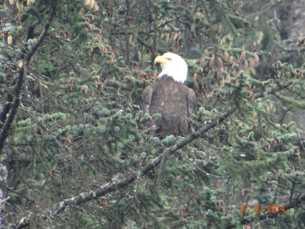
The last of the coastal towns on our agenda was Valdez, the southern terminus of the Alaska Pipeline. Because of that distinction and the history of the Exxon Valdez oil tanker spill, I was expecting more of an industrial look to Valdez. It sits on the bay and on the town side of the bay there is a typical small boat harbor and a bigger dock where cruise ships and ferries dock. Across the bay is where the pipeline terminates and there is a rather large tank farm there, but it was much smaller than I expected. We drove over to that side of the bay and in the shadow of the tank farm there is a thriving salmon hatchery and there were bald eagles everywhere. Nature seems to be coexisting quite nicely with the petroleum industry in this area. But the thing that Valdez, Seward and Homer all have in common is that there is one road into each town and the scenery along those roads is just spectacular. One final note on Valdez that I found interesting is that in 1964 a huge earthquake rocked all of southern Alaska. It also created a tsunami that pretty much totally destroyed Valdez. The damage was so great that subsequent geologic studies determined that the land under the town was no longer stable enough to rebuild on. But an area four miles away was stable and vacant. It was owned by a couple of families who made fortunes in the gold mining business and they donated the land so the town could be rebuilt there. The few houses that were not destroyed were moved after the new town was laid out. For this reason, Valdez had unusually wide streets and more of “planned” look to it than most towns that just grew up.


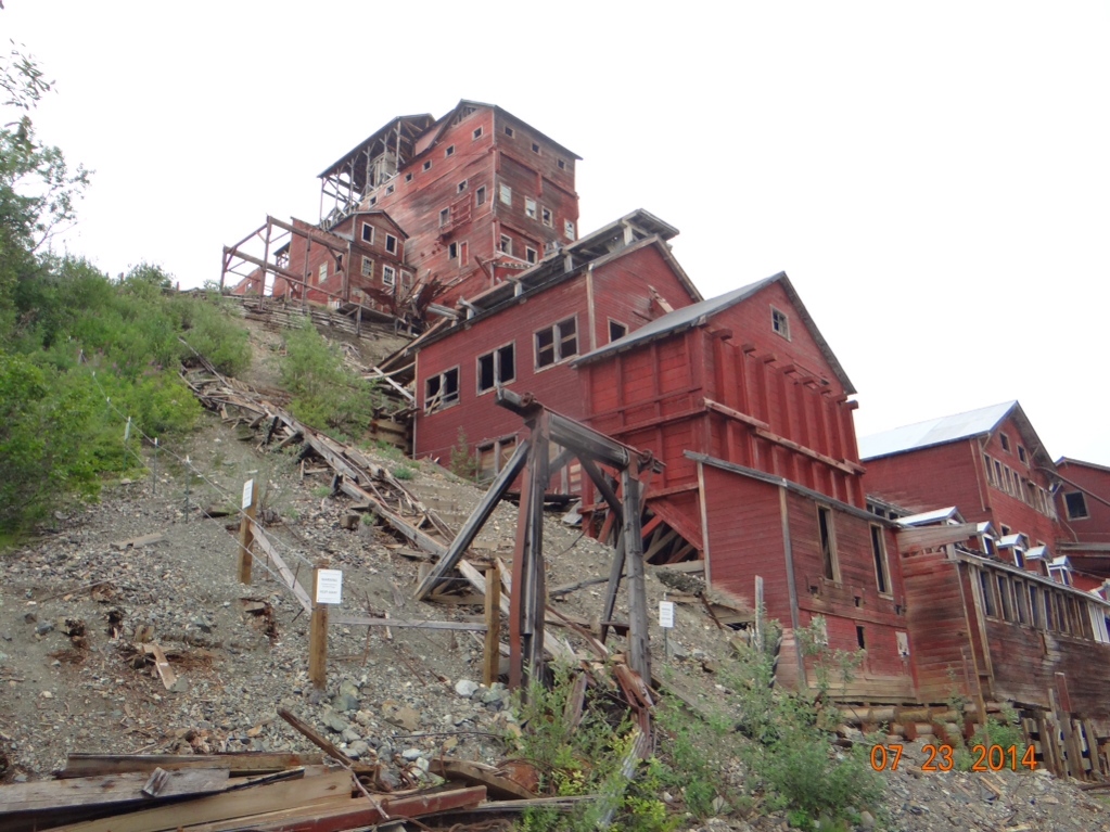
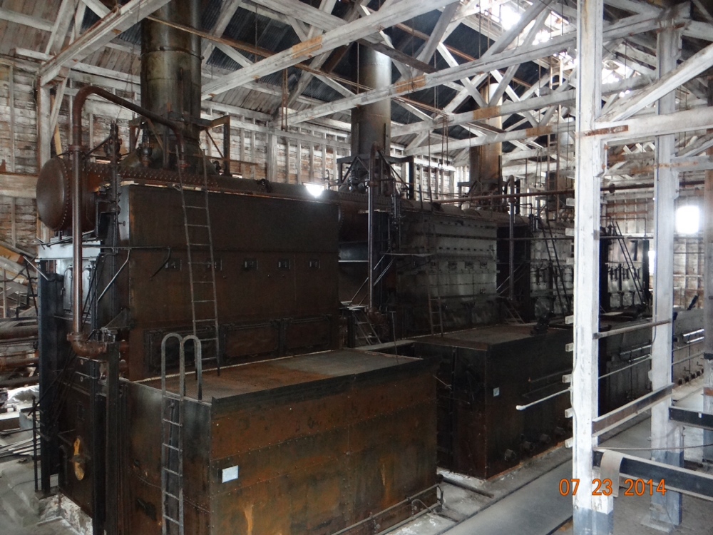
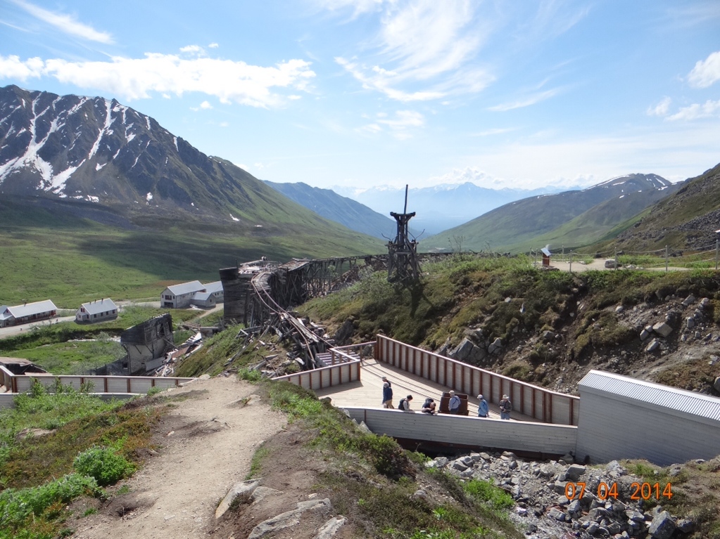
After leaving Valdez we camped and did a car trip into the Wrangell-St Elias National Park and the towns of McCarthy and Kennecott. This involved a sixty mile drive on the McCarthy Road. The road is gravel, and where it is not washboarded it is potholed. Furthermore it is an old railroad bed and the old rail spikes work their way up through the gravel resulting in an abundance of flat tires. (Joan didn’t tell me this until we drove it both ways.) The Kennecott Copper Corp began doing business here in the early 1900’s and the operation continued until the 1930’s when the ore was depleted. Because of the remote location everything used in the mining operation was just left behind when the company pulled out. Today the national park service is stabilizing the buildings and preserving things just as they were. It is a fascinating operation to see. While we were in Kennecott I was looking at an old peice of machinery and trying to figure out what it was used for. Joan had no interest in it so she went down a little road behind the building to check out the view of the glacier below. When she topped the hill she saw a bear about 200 feet below her. Joan used to be a good competitive runner, but now she claims her knees are too bad to run. However, I heard her yell at me and when I looked up she was coming toward me and exhibiting the same running speed that used to win her all of those trophies.


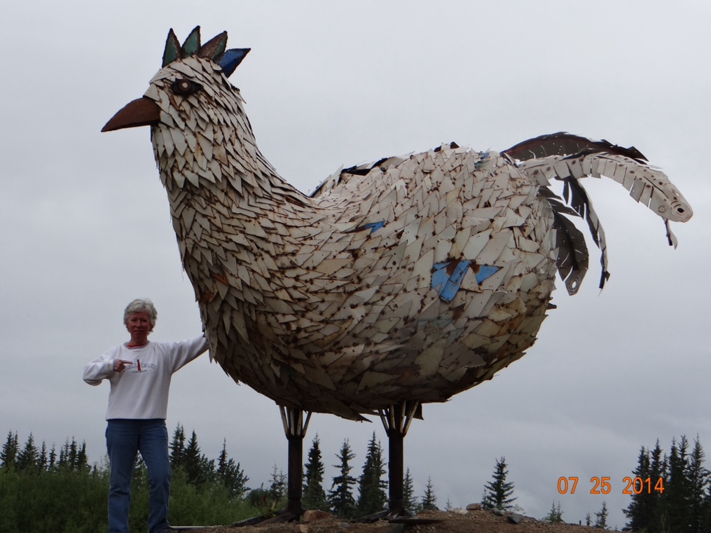
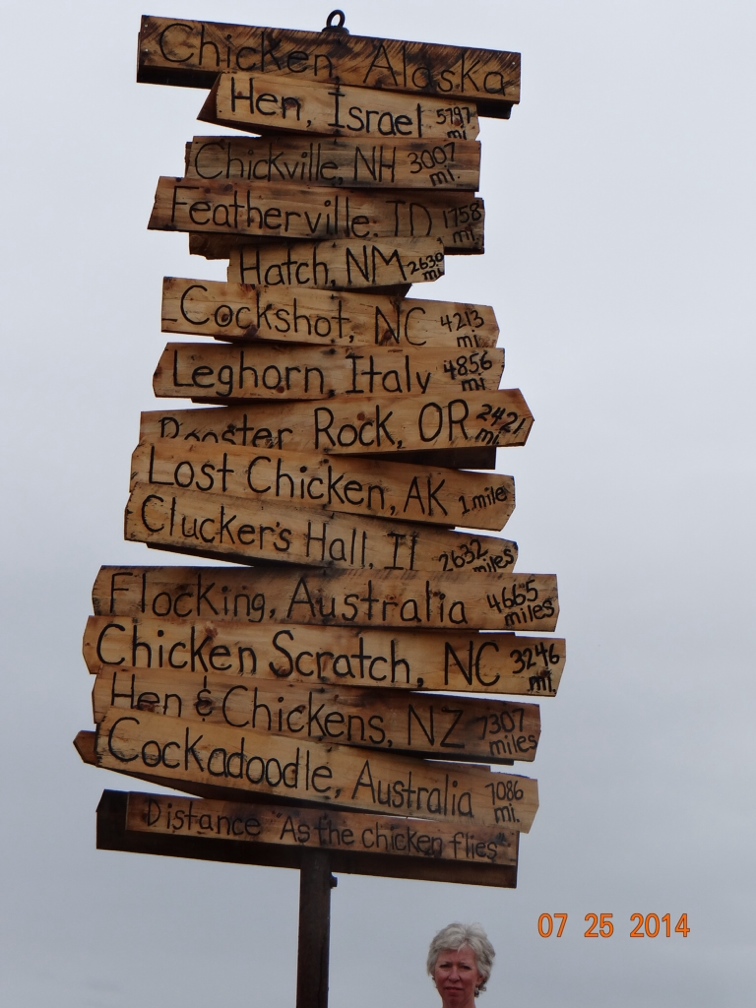
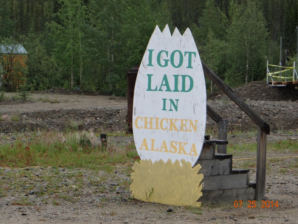
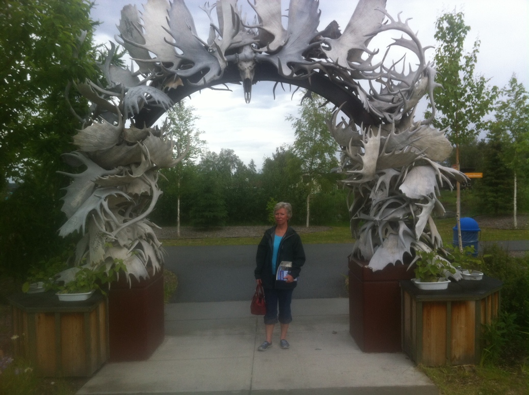
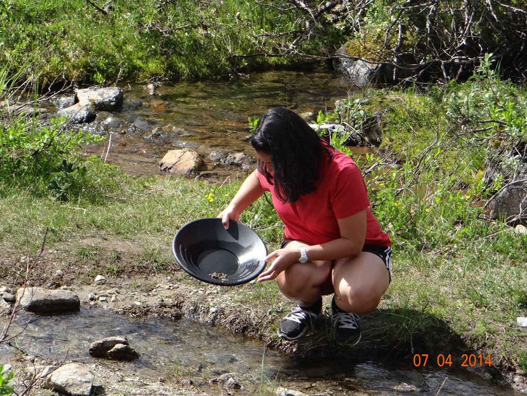
Our final adventure in Alaska was yesterday in the town of Chicken. Chicken is a tiny town way up in the mountains between Alaska and the Yukon Territory in Canada. It has a full time population of 15 which swells to 25 to 30 in the tourist season. It is about sixty five miles from Tok on a road that is closed all winter. They say that in the winter it gets to about eighty below zero. There are no inside toilets in the town and all communication with the outside world is via satellite which is sketchy on overcast days. Gold was discovered near there about five years before the Klondike gold rush. And even today there are some who pan for gold and must find enough to provide a living. Why name your town Chicken? When it was settled the residents wanted to name it Ptarmigan after the northern type of grouse with the feathered legs. However, nobody involved in the naming process was exactly sure how to spell Ptarmigan. So finally they said the hell with it and named it Chicken which is another name that some people of that day used for Ptarmigan. In the center of town is a large statue of a chicken that was fabricated in Homer out of old student lockers from the high school there. It was then transported to Chicken. Im guessing that is a distance of close to three hundred miles.


I’ve gotten lots of positive feedback on this blog. People seem to be enjoying reading it. And even though the Alaska portion of the journey is over I plan to continue posting as we head down the coast through Washington, Oregon and California (unless we’ve sold California by then). Along the way we plan to hit as many national parks as is practical and camp in as many state parks as can accommodate our motorhome. So stay tuned.

Glaciers, Gold and Knives

I believe it was Einstein who said that insanity (or perhaps stupidity) is doing the same thing over and over again, and expecting a different result.  I’ve usually heard this mentioned in conjunction with an election wherein we the people keep sending the same bad politicians back to Washington and then spend the next two, four or six years complaining about the terrible job they are doing.  One politician in particular springs to my mind at the moment.  Currently though what made me think of Einstein’s expression is shopping for a new kitchen knife.

When we outfitted the motorhome we bought mostly cheap and lightweight items thinking that they would be infrequently used and high quality stuff was not necessary.  So our kitchen knife probably came from Walmart or another discount store.  Slicing potatoes or onions with it could be accomplished just as well with a wooden spoon.  When I thought about this trip I thought about replacing the knife.  But I figured that since we were headed to Alaska I would be able to find some outdoorsy type of craftsman that made his own high quality knives and I would buy one of those.  And I have seen some up here.  But they have all been fancy highly polished or chromed steel blades embossed with an outdoor scene and mounted in a bone handle or an elkhorn handle and priced at $175 or more.  Not really the kind of knife you want to carelessly throw in the drawer with your spatula and can opener, so I have passed on them.

While we were spending four nights in Anchorage I saw that there is a Cabela’s store there.  I thought that I could probably pick up a fish filleting knife there for $15-20 that would be sharp and last me until I can get back home and buy a good kitchen knife.  So, off we go to Cabela’s.  The first thing Joan said when we went in was that we should separate, and I could call her on the cell when I was ready to go.  She headed for the clothing and shoe departments and I headed for the fishing gear.  There were no knives in the fishing section so I had to look elsewhere.  Finally I found them, picked up a nice one for $18 and called Joan.  She told me that she was in the fitting room, and I knew I was in trouble.  I’ve already described to you in an earlier post the visit Joan, Mandy and I made to a Cabela’s store in Nebraska several years ago.  At that time I had to take out a second mortgage on our house to get home!  This one was not quite that bad, but my cheap filleting knife still ended up costing me $174.  Do you see the similarity between that amount and the cost of the really fancy handcrafted elk handled knife I could have bought?  This is where Einstein had it right.

Before arriving in Anchorage we spent four nights in Palmer.  Palmer was somewhat interesting partly because it was a town that was settled during the Great Depression by homesteaders.  The federal government persuaded “farm types” from Minnesota, Michigan and Wisconsin to travel to Palmer to settle in the area.  Upon arrival they learned that the area was not exactly as the government had described it, (surprise surprise!) and almost one third of them returned home.  However, enough stayed to settle the area and their descendents are still there and very proud of their heritage.  I’ve never really thought of Alaska as an agricultural state, but the Palmer area is escpecially suited for it.  The soil is rich and the average of 19 hours per day of sunlight in the summer makes it ideal.  The literature on the area describes record setting 60 pound heads of cabbage and carrots weighing 8 pounds.

A few miles outside of Palmer we were able to visit the remains of an abandoned gold mine that is now a state park.  It was actually a productive mine in the 1930’s to the 1950’s and employed several hundred people.  Much of the equipment and ancillary buildings are still there and there were also a few people actually panning the stream that ran though it for gold.  I did not see any of them jump up and yell “Eureka!!” so I’m assuming they were not having much luck.


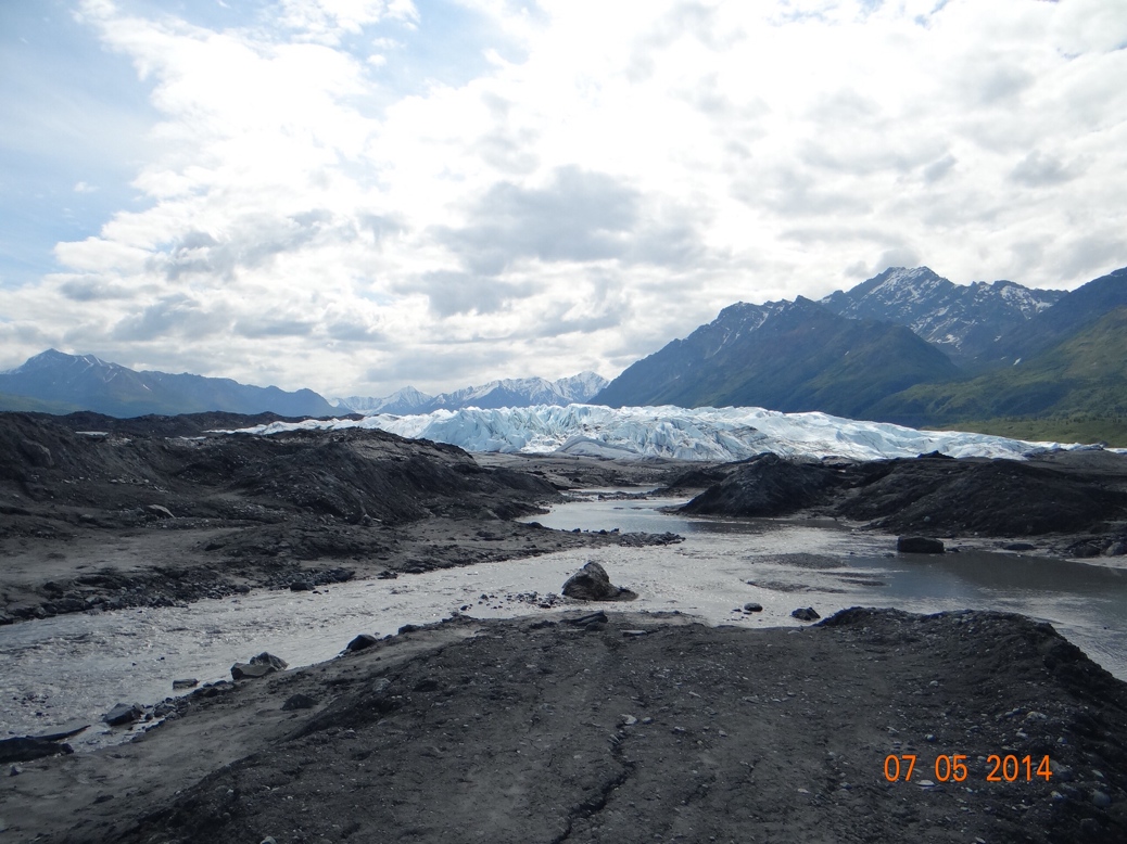
On another day we headed out of Palmer in a differrent direction and we were able to drive close and then walk right up to a glacier.  This particular glacier was in retreat as so many are, and the area below it reminded me of a West Virginia strip mine.  Not exactly the most beautiful sight but, I guess its a similar process that causes both, one man made, the other natural.  We could have donned ice crampons and climbed right up onto the ice.  We chose not to do that because the idea of trying to drive WildaBeast back to Florida with a broken leg made me hesitate.


After Palmer we spent four days in Anchorage.  The highlight of those days for me was a car trip to Whittier and a five hour glacier viewing cruise that we took.  The road to Whittier involves a two and one half mile one lane tunnel that motor vehicles also share with the trains.  Going to Whittier they open the tunnel for cars on the hour.  You drive up to the tunnel entrance and get in line and when the clock strikes the hour they open the gates and you can drive through.  Coming out of Whittier it is the same process, but it is on the half hour.  However, if a train comes up going either way, it takes priority over motor vehicles.

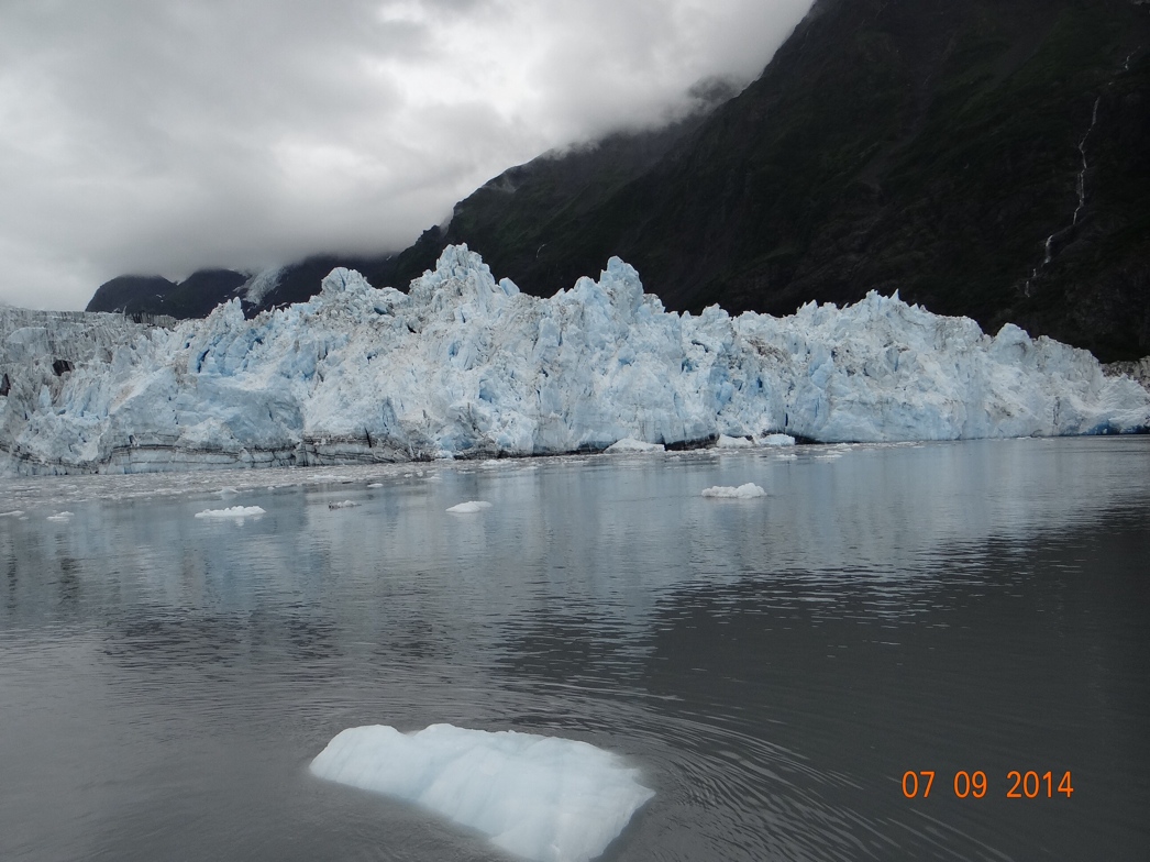
The glacier cruise out of Whittier was just fantastic and is probably the highlight of the whole trip so far for me.  It tooks us to 26 different glaciers.  We got to “park” within 1/4 mile of a very active calving glacier.  The day was overcast which is supposedly the best conditions for seeing the deep blue of some of the most dense ice.  Along the way we also saw humpback whales, sea otters, sea lions, and bald eagles.  There was also a forest ranger on the cruise and her narration and pointing out interesting features along the way made the experience that much more enjoyable.

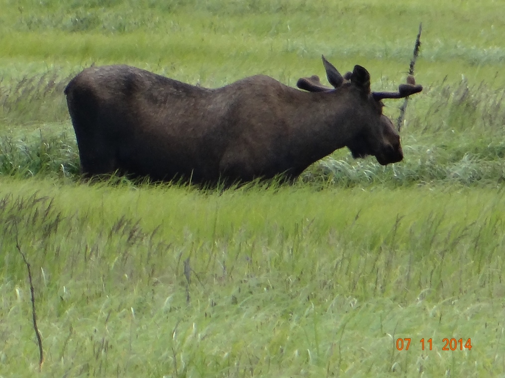
From Anchorage we have since moved on to Soldotna in the Kenai Peninsula where I am writing this.  In addition to the spectacular scenery, including our first good look at a bull moose, the fishing here in the Kenai looks to be just outstanding.  The salmon are running everywhere.  I have not fished because I disposed of all of my gear when I left West Virginia.  Its probably just as well because Joan would probably not be able to pull me away from it in time for us to head out of here and get south before the snow flies.  On the other hand I could stop at Cabela’s to pick some up, but you and I both know now how that would end.


NO Luck in Denali

I am writing this from Palmer, Alaska where we arrived this morning from Wasilla.  Palmer is around 50 miles outside of Anchorage.

Joan and I have now been on the road two months along with our dog, Daisy.  We may not quite like each other as well as we did when we left Ponce Inlet, but I think we will still be able to make the marriage endure.  I guess there are some little things that irritate with so much time together, even in a 44 year marriage.  For instance—when after a long day of driving I stop and the car battery is dead, I am pretty apt to utter words Joan does not use and does not like to hear from me.  But at the moment it makes me feel better even though she gets irritated with me.  And then there is Joan’s habit of having to read OUT LOUD every road sign that we pass.  She’s been doing this ever since I have known her, and on a one or two day trip it is fine.  But do you have any idea how many road signs we have passed on this 6,000 mile (so far) drive?!?!  And she reads them with such enthusiam too!—like its the most amazing road sign ever!

When we arrive at a new campground we have certain tasks that need to be performed to get set up for the evening.  There is always an electric line to be plugged in, circuit breakers to be switched on, and a water hose to be connected between the motorhome and camp water supply, and usually a sewer line to deal with.  Most other wives that I see in campers stay inside during this process, but Joan likes to come out with me and help, and I certainly appreciate her doing that.  Now, I don’t know if I have previously mentioned Joan’s mechanical abilities.  Probably not because she is just a tad weak in that area.  Lately she has started hooking up the water line.  About 95% of the time she turns the connection the wrong way.  And I’m there with my smart ass comment that “this is not rocket science”.  Its “righty tighty and lefty loosey”.  Then in typical woman fashion she begins arguing with me about which way is right and which way is left!!  And she points out to me that she actually knows TWO real life rocket scientists.

Speaking of rocket science, when I was in the 6th grade at First Ward Elementary School in Elkins, West Virginia my teacher was Mr. Pingley.  I remember him coming in one day, and he was all disturbed about the Soviets launching Sputnik, the first satellite.  He was quite alarmed that they were so far ahead of us Americans in the space and technology area.  I, on the other hand had just begun to look at some of my classmates (with names like Joyce Mullins, Linda Gibson or Shiela Hall) in a different manner.  The girls were on my mind and I could not get too excited about Sputnik.  I mention this because today I have become so dependent on satellites.  I’m not sure I could have gotten up here without my GPS to guide me.  And Wilda has a satellite system on the roof wherein I push a button inside the coach and the satellite dish raises up, looks around and locks onto a TV signal.  And as we drive along we can be listening to satellite radio from Sirius.  When we were up in Fairbanks (as far north as we went) neither the TV nor the radio could receive signals because the curvature of the earth blocked the reception.  There were satellite dishes up there, but where we have one that measures maybe 18 inches, those were about 3-1/2 feet in diameter, and rather than look up into the sky as they do elsewhere, up there they actually appeared to be looking at the ground.  Maybe Joan can get one of her two rocket scientist friends to explain to me how that works.
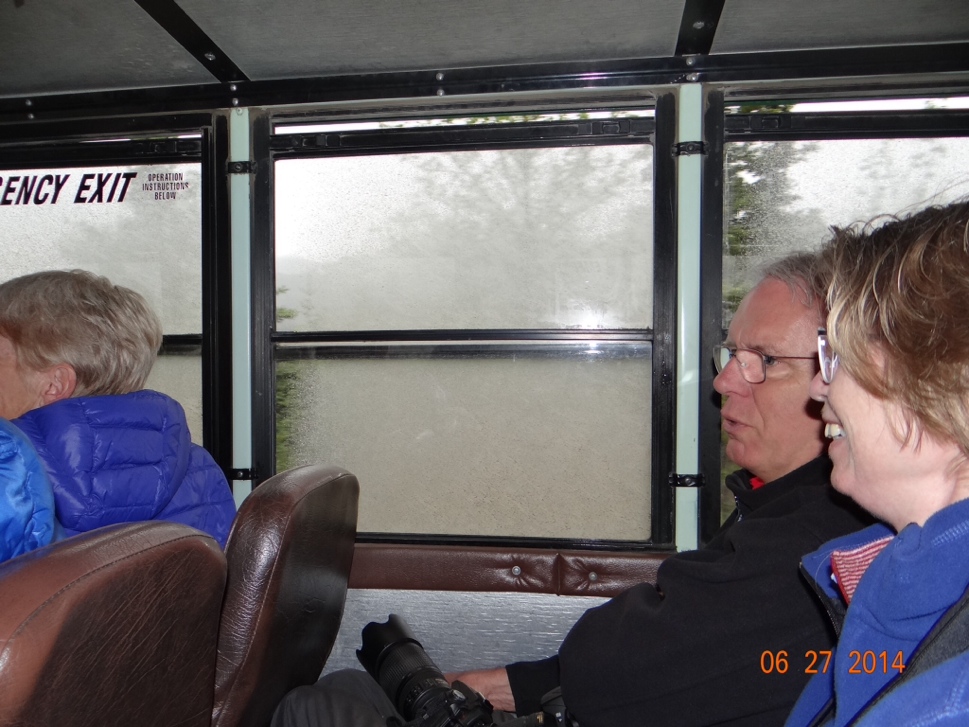
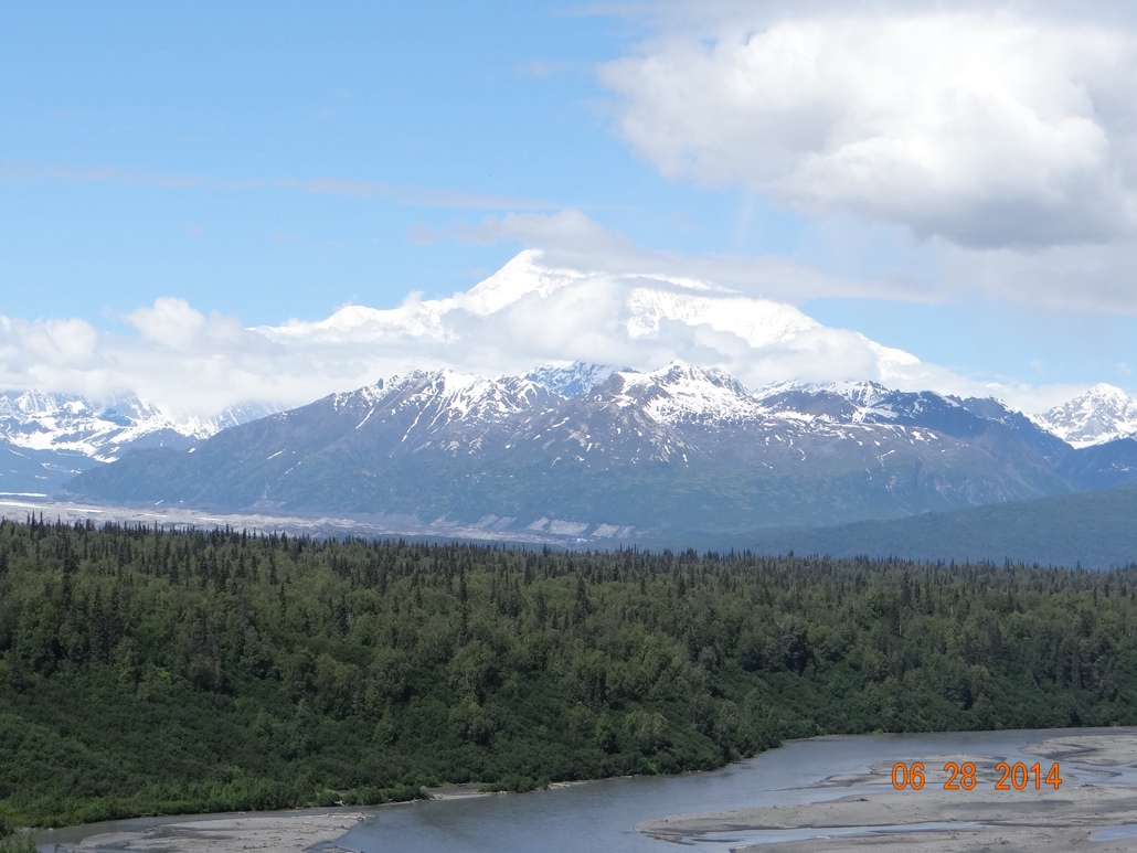
The day we left Fairbanks en route to Denali National Park it was raining and foggy.  But by the end of the relatively short 100 mile drive the sun had come out.  Access to Denali is much more limited than other national parks.  There is essentially one road into the interior and it is about 90 miles long, but with only the first 15 miles paved and open to private vehicles.  With an afternoon to kill, and it being a nice day, we drove the 15 miles and enjoyed the scenery.  We did not see any wildlife, but got some decent views of Mt. McKinley, the tallest peak in North America.  The weather forecast for the next day was iffy, but we decided to buy tickets for a 130 mile round trip bus ride into the park interior on the following day.  The departure was for 9:30AM, returning at 5:30PM, but in the middle of the night it started raining really hard.  But we were committed and stuck with our plan.  We made arrangements with the campground to have Daisy walked in the afternoon, we put a meal in the crock pot for our 5:30 return and headed out figuring how bad can it be??  Well, it turned out to be the bus ride from hell.  The bus driver was a nice guy and told us that the first part of the ride on the paved road rarely yielded much wildlife viewing, but after that on the gravel portion we should see, moose, caribou, grizzly bears and Dahl sheep.  He was almost sure that they would be out in the wet weather because it was cooler.  He was right about the beginning of the ride. We saw nothing at all on the first 15 miles.  And once we hit the gravel portion of the wet road the bus started kicking up a muddy spray that soon coated all of the side windows leaving no visibility.  The driver noted that, apologized, and told us we could squeegee them off at the upcoming rest stops.  We all did that at the first rest stop about 30 miles into the ride even though by now the rain had really picked up and a low fog had settled in.  Mt. McKinley was nowhere to be seen in the fog.  Just about as soon as we started driving again the windows were muddied as bad as before the cleaning.  Then we arrived at the second rest stop which was about 55 miles into the 65 mile one way trip.  Again we cleaned the windows and just as the bus was about ready to pull out the driver was radioed that there was an accident up ahead involving construction vehicles that had overturned and were blocking the road.  He was instructed to stay put.  Which we did for the next two and one half hours.  This meant that we would now be returning at 8:00PM rather than 5:30.  So much for our crock pot dinner, and we were worried about the now “regular” Daisy going that long without being out.  Once the road reopened and buses that had departed ahead of ours started returning we managed to get a seat on one, and head back early without completing the trip.  We got back around 7:00PM, salvaged the crock pot meal and Daisy was fine.  On the bright side, we met another couple on the bus who are motorhoming from California (surprisingly they’re not fruits, nuts or flakes) and we have been having some good times with them.  And once we left Denali, the weather improved and we got some beautiful pictures of Mt. McKinly on our drive down to Wasilla the following day.


Someone asked me if we were staying with the Palins in Wasilla.  We drove all over town trying to hook up with Sarah and get invited to stay or at least have dinner with she and Todd, but no such luck.  We did visit the Iditerod headquarters in Wasilla, and saw some interesting exhibits about the race.  They even had some dogs there in training and you could get a ride behind them in one of the wheeled sleds they use to train.  The dogs were smaller than I expected.  Not much bigger than Daisy’s sixty pounds, but looked like they could run forever, which is what they do I guess.  I also noted that beside many of the roads around Wasilla there are dirt tracks like bike trails that they use for training the sled dogs.  They are really into that sport in this immediate area.

One thing that has surprised me up here and seems to be a sign of the times is the number of people living permanently in these campgrounds in very old and decrepit campers.  Several of the campgrounds seem to rent spaces in the interior to overnight travelers such as us, and rent the perimeter spots to folks who are down on their luck.  I’ve seen that in the lower 48 as well, but its not as prevalent as here.  And I cannot even imagine spending a winter  here in some of these units I have seen.


Even though we did not see a bull moose in Denali or anywhere else on the trip so far, Joan thinks she has seen some signs that they are around the area.


Ferrying the Beast, Towing the Toad, Daisy is Regular

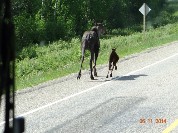
I finally got my device to upload photos to the iPad from the camera.  I described the moose cow and calf in an earlier post.  Here they are as photographed from out the windshield of the motorhome with the windshield wiper on the left.  Learning to crop photos is a task for another day.


I am writing this from the city of Fairbanks where we arrived yesterday.  My previous post I believe was from Skagway which is a little town on the southeastern Alaska coast where most of the cruise ships seem to dock.  We arrived there on a Sunday with beautiful blue skies and temperatures in the high 60’s, and we ended up spending four nights there.  I was quite taken with the town on that Sunday, but each day we spent there I liked it less and less.  Upon our arrival there was one cruise ship docked in the harbor, but it appeared to be only sitting there for maintenance puposes.  The streets were pretty much deserted as with many small towns on a Sunday afternoon.  On Monday another cruise ship arrived discharging its load of passengers.  On Tuesday three more ships were in the harbor for a total now of five, and all of a sudden the sleepy little village of Skagway had become all of the things that I hated about Banff, Pigeon Forge, etc.  Also on Tuesday the weather turned rainy to add to the aggravation of being elbow to elbow with the cruisers.  At that point we wanted to leave Wednesday morning, but we had changed our minds about our travel mode.  We orginally planned on driving back up the Klondike Highway the way we had come in to Skagway.  But we discovered a ferry option to take us fourteen miles across Skagway Bay to the town of Haines.  The fourteen mile ferry ride would save us 360 miles of driving to reach Haines by highway, but we could not book passage until Thursday.

I have not been on a whole lot of ferries in my lifetime and I have certainly never been on one with a forty foot long motorhome.  When I was in my 20’s and in college I spent a year driving a school bus to help meet our expenses.  That was a terrific background to have to prepare me for driving the WildaBeast.  But even with that experience, when we bought the motorhome it was with sweaty palms that I arrived at the dealership in Tampa to take delivery.  After almost 11,000 miles I have become quite comfortable driving it, but when we bought the ferry tickets I was expecting that someone from the ship would actually load it.  I had read somewhere that they do that, so I thought that’s how it would be here.  Imagine my surprise when I was told that me driving it was part of the deal.  It involved driving down a fairly steep and narrow ramp to what seemed a tiny concrete dock, surrounded, of course by ocean.  Then making a sharp right turn on the tiny dock to another shorter ramp that led up to the ship.  And from there driving into the belly of the ship through a side door, and making an immediate left turn before driving to the aft portion of the ferry.  Once aft I had to make a U-turn and come back up the other side to park.  Now the key words in those previous sentences are SHARP right turn, IMMEDIATE left turn and U-TURN.  The one thing I have learned about Wilda is she does not do anything SHARP or IMMEDIATE, and she did not do so in this situation either.  The manuevering involved a few back ups and try again.  But the guys on the ship directing me were great and had obviously dealt with geezers in big machines before and they got us situated without a hitch.  The ride was beautiful and disembarking was a much simpler process with just a simple right turn and a level ramp to solid ground.

One reason that we wanted to eliminate driving the 360 miles to Haines was a problem we have been having with the car we are towing.  On several occasions we have arrived at our destination at the end of the day with a dead car battery.  This continues to plague us. At first I thought there must be something wrong with the car, but I have come to the conclusion that when the wiring between the motorhome and the car was done a mistake was made somewhere.  This is something that I will investigate when we get back to the “lower 48”.  On the trip over the Alaska Highway there are many desolate stretches hundreds of miles long.  There are lots of big wide places along the way to pull off and park overnight at no charge.  We did this very late one afternoon and when we went back to the car the battery was really dead.  I have a charger and hooked that up and got the battery charged back up overnight.  However, this car has something called an Intellikey.  It is just one of those key fob clicker things which works electronically, but there is no actual key.  The problem is that if the battery in the car goes dead it is sometimes hard to get the clicker and the car communicating with each other again.  And the car ignition switch needs to be in “accessory mode” to be towed so that the transmission lubricates properly.  With the key fob not working I had no way to put it in “accessory mode”.   Fortunately Ford has a roadside assistance service that you can call.  However, we were in a spot where there was no cell phone service.  We had no choice in the morning but to unhook the car and drive away.  We drove 60 miles before we could get a cell signal.  The nearest towing service and Ford dealer were in Whitehorse, Yukon Territory and that was 140 miles from where the car was sitting.  Ford sent the tow truck out, they picked up the car and towed it the 140 miles to the Whitehorse Ford dealer.  280 miles round trip for the tow truck driver.  Glad I did not have to pay that bill!!!  The dealer at first was telling me they would TRY to look at it, but they were backed up and could not promise to get to it anytime in the next week.  But my begging/pleading/whining paid off and the following day they had the keys reprogrammed and we were back on the road.  Since then we have been stopping about every three hours to start the car and let it run enough to charge the battery.  So far that is working well, but it is a nuisance.

Alaska is in the Alaska time zone which is one zone further west than the Pacific time zone.  There is a four hour time difference between Alaska and our home in Florida.  So far Joan and I have adjusted well to the time difference and to the long hours of daylight up here.  This time of year it never gets really dark, but rather just what I would call twilight.  The twilight does not happen until about 1:00AM and then it starts to brighten up again about 3:00AM.  By 4:00AM it is fully light just like noon in Florida.  Daisy, who is our ten year old sixty pound Border Collie, and the third member of our traveling party has been a different story.  In Florida she comes into the bedroom about 6:00AM to roust us out.  In Alaska she was doing this about 4:00AM which is too early even for me.  In just the last few days however she seems to be beginning to get used to the time and daylight hours difference.  And when we were traveling on the aforementioned Alaska Highway we were having to spend what seemed like hours walking back and forth with her to get her to “go potty”.  (Joan’s term, but probably more appropriate for this forum than what I usually say.). My theory is that there were so many wild animal smells out there that she was not familiar with that she was somewhat distracted.  But since we have been back in civilization this problem seems to have solved itself also.  She’s back to being a “regular” dog again.

We have decided that Fairbanks is as far north as we are going because the roads north of here get really rough.  From here we will head south to Denali National Park and then on toward Anchorage where I hope to get the crabs.


Father’s Day in Alaska

Before I retired we lived in western Pennsylvania and in those days both Joan and I were serious long distance runners.  For a period of over 30 years we trained on almost a daily basis and frequently competed in road races on the weekends.  I was just a middle of the pack racer for most of those years, but Joan was better and usually brought home a trophy.  In those days we watched what we ate and all of the miles we put in kept us on the slim side.  In other words, I didn’t always have this big gut that I am carrying around now and I was very weight concious.  This was the environment that Mandy was raised in, and she actually was instrumental in starting the first girl’s cross country team at her small high school.

When it came time for Mandy to pick a college she decided to go to Virginia Tech in Blacksburg, Virginia.  Blacksburg was about a seven hour drive from where we lived, so when we dropped her off there in September we did not see her again until she came home for Christmas vacation.   When she arrived home I could see that she had “porked up” some as kids are wont to do on dorm foods and when they discover beer.  I didn’t say anything to her about her weight over the two or three weeks she was home.  She returned to college and was there for her January 10 birthday.  Being the subtle dad that I am however, I bought a bathroom scale and sent it to her as a birthday present.  Usually when I would give her something I would get a call or a card.  But this time no acknowledgement whatsoever.  At some point, perhaps a year or more later, the subject did finally come up and she was still mad about it. Oh well!

Now we fast forward to today.  I am not running any longer and I take a ton of prescription medications for various ailments I am plagued with.  These meds come to me by mail and I have it set up that they are automatically sent by the mail order pharmacy when I am about to run out.  While we are traveling on this extended trip we had our mail forwarded to Mandy in Houston and when she gets my meds she finds out where we are going to be in a few days and sends the meds to me “General Delivery” in that city.  On Monday I picked up a package of meds at the post office in Skagway.  Also in the package were two very nice Father’s Day cards, one from Mandy and Dave and another from the twin grandbabies.  But a more curious inclusion in the package was a set of toe nail clippers.  Clipping toe nails is something I frequently neglect and in the warm South I am almost always in a pair of flip flops.  I can only conclude that she noticed while we were visiting, and decided after almost twenty years to pay me back for that set of bathroom scales.  GOTCHA DAD!

Today we leave Skagway.  There is only one road to Skagway and it ends here.  Rather than drive back up the way we came we have decided to load WildaBeast and the car on a ferry and cruise the fourteen miles across the bay to the city of Haines. If we did the drive to Haines it would be 360 miles.  My friend Fred highly recommends a visit to the hammer museum in Haines so we certainly do not want to miss that!