
Early Land Registers of Tennessee 1778 - 1927
(C. Avis Catalog entry #887)
Source: Ancestry.com. Tennessee, Early Land Registers, 1778-1927 [database on-line]. Lehi, UT, USA: Ancestry.com Operations, Inc., 2016. Original Data: Tennessee. Division of Archives, Land Office, and Museum. Early Tennessee/North Carolina Land Records, 1783–1927, Record Group 50. Tennessee State Library and Archives, Nashville, Tennessee.
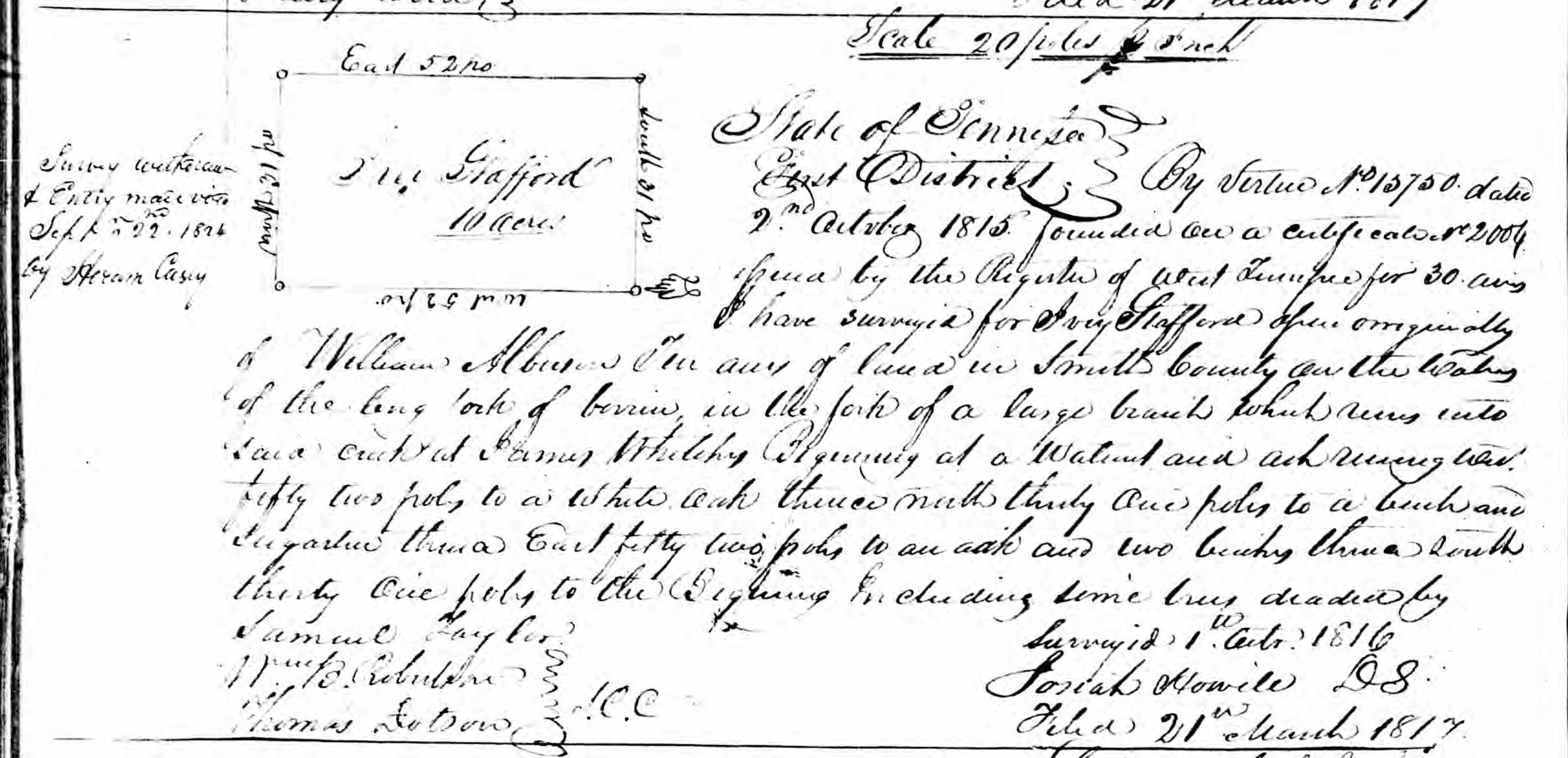
Ivey Stafford
10 acres
Scale 20 poles [?] inch
State of Tennessee
East District
By virtue No. 15750 dated 2nd October 1815 founded on a certificate no. 2004 issued by the Register of West Tennessee for 30 acres I have surveyed for Ivey Stafford [?] originally of William Albu[?] Ten acres of land in Smith County on the [?] of the long fork of [?] in the fork of a large branch which runs into said creek at James Whitely Beginning at a [?] and ash running West fifty two poles to a white oak thence north thirty one poles to a beech and sugartree thence East fifty two poles to an oak and two beeches thence south thirty one poles to the Begining Including same trees deaded by
Samuel Taylor
William B. Robertson
Thomas Dotson
I.C.C.
Surveyed 1st Octr 1816
Josiah Howele DS
Filed 21st March 1817
Survey withdrawn & Entry [?] Septr 22nd 1824 by Heccorn[?] Casey